Visualizzazione post con etichetta Bertinetto Bartolomeo Davide Travel Trail. Mostra tutti i post

sabato 23 novembre 2024

TRAVEL TRAILER: Among the Hills of Elba Island

Monte Capanne


360° Panorama from Monte Capanne


The evolution is now inevitable. Among the thousand places I have been able to reach always starting from home on foot, I believe I have reached a limit because there is not much left that is interesting to explore from my residence. Therefore, with this adventure, I am starting a new way of doing long-distance walks, transforming this passion into TRAVEL TRAILER, because the places in the world to visit on foot over great distances are many, infinite!

Tour of Elba Island from Lacona to Monte Capanne


Let's talk about the journey around Elba Island. The tour took place on July 24, 2021, starting at 5:45 AM from Stella Mare camping in Lacona (Capoliveri beach). The journey began by following the route created the night before on the computer and loaded onto the wrist GPS. For me, the wrist GPS is an indispensable tool that allows me to embark on hikes never seen or attempted before in a fairly immediate and easy way. Using an old map on-site every time there's a doubt about the path would interrupt the journey too often and make it difficult to stay within acceptable timing.

The tour of Elba Island in the direction of Monte Capanne immediately proved to be tortuous and full of steep climbs on uneven trails, rich in boulders and deep ruts left by motorcycles and rainwater.

Initially, after a brief illusion of 'speed,' I faced the first steep climb, which is not so bad when you're still fresh and full of energy—you easily overcome all difficulties. The real challenge, however, comes later. After passing the small plain of the Lacona area, I began the steep climb towards Monte Barbatoia (359m), passing through Serra del Pero. Upon reaching the ridge, you can glimpse the two sea sides of the island through the trees. I proceed, skirting the summit of Monte San Martino (370m) with a progressive upward direction. I am on the GTE (Grande Traversata Elba). I reach the mountain site 'Costa del Gualdarone,' and the photos fly. From here, I start descending at a fairly smooth pace, one of the few stretches where I can run on the trail. I arrive at the settlement and find myself in Literno, skirting a flat path along 'Via per Portoferraio,' with an unexpected obstacle: a large gate in the middle of a road marked on the map! I climb over it.


La Pila Airport seen from the hills


Monte Capanne in the distance


Typical stretch of steep, uneven trail


A new climb begins, passing through Vigne Giunche, following the dirt road "Via dei Forcioni" up to Poggio San Prospero (402m). From here, a dense forest starts with a steep climb that will take me to Monte Perone (603m), a stunning place but marred by large phone repeaters (a common reality on many peaks of the island). Then I pass through a picnic area with many tables and a small closed wooden shelter. I gain more altitude and reach Monte Maolo (750m) and shortly after, I forget to check the GPS at a junction and take the wrong path, climbing for a good kilometer towards Monte Le Calanche (which I will cross on the way back) and retrace my steps to get back on track. I am at the limit of the island's vegetation, and long stretches of rugged scree along the edge of the cliff begin. I climb further, and here the via ferrata paths arrive at the foot of Monte Capanne (1019m), which I reach the summit with some climbing. There are many people up there, and soon I discover the reason: there is a chairlift. Upon arrival, I sit on the highest rock and start with some video and panoramic photos. It is beautiful to see the entire sea and clearly the outline of the whole island. Italy on one side, Capraia Island, and other islets of the Tuscan Archipelago. The breathtaking panorama makes it feel like being on top of the world on this small Elba Island! I go in search of the bar, but it is closed, a bit disheartening because I have less than half a liter of water left in my bottle. So, I switch from one sip every 30 minutes to one sip every hour. It is not easy to endure and go on despite everything; the heat is intense (I estimate 35 degrees) and the sun is scorching.

After Monte Capanne, I begin the return journey, different from the outbound route, and more rugged. I retrace the via ferrata paths and start a dense series of consecutive peaks. So, along the ridge, I cross many boulders, proceeding slowly but with great attention to the dangers, reaching Monte Calanche already mentioned (905m) and still along the ridge arriving at the summit of Monte Tiratoio (810m). From these hills, I see valleys on one side leading to the sea and a deep cliff on the other side. I cross a steep scree and reach Masso della Quata (746m), a very dry place where I notice ancient stone constructions, reinforced in more recent times, I believe with reinforced concrete. Here I also find some basins that may have been made by humans to collect the scarce rainwater. I go on for several kilometers, and the temperature becomes unbearable. Only dry and prickly bushes, but here in some stretches, I manage to run even though I am very dehydrated.


180° Photo during the ascent


Various directions


I hold on a bit longer and arrive at the first village descending from Monte Capanne and find the much-desired fountain in San Piero di Campo (250m), where I literally throw myself under it, drinking who knows how much, filling my bottles, and eating something. I slowly pass through the village because, after all that water at once, I know it's better to wait before running again to avoid stomach problems... This often happens to inexperienced athletes. After about twenty minutes, I briefly return to the asphalt and start jogging again, then back on the dirt road, where I find a beautiful little church that I photograph without stopping too long. I cross the dry riverbed Fosso del Bovalico and enter a new municipality (Marina di Campo); by now, I am on the coast at sea level.


 Little church between San Piero and Marina di Campo

It's strange how, in a maritime situation, you gain and lose elevation, often reaching zero level (at sea), an unusual situation for someone like me, accustomed to the high alpine altitudes of the Po Valley. I had been dreaming of a nice coffee and a bottle of sparkling water for a while. So, I continue along the coast, scanning the places in search of a bar. I find a busy kiosk and, with my mask on, I stop, taking the opportunity to share my adventure with the barista and asking for some information about the remaining route. I enjoy everything while sitting at a quiet table and then resume a good pace, jogging through the small flat areas present, and soon the steep climbs resume, just to keep the habit.


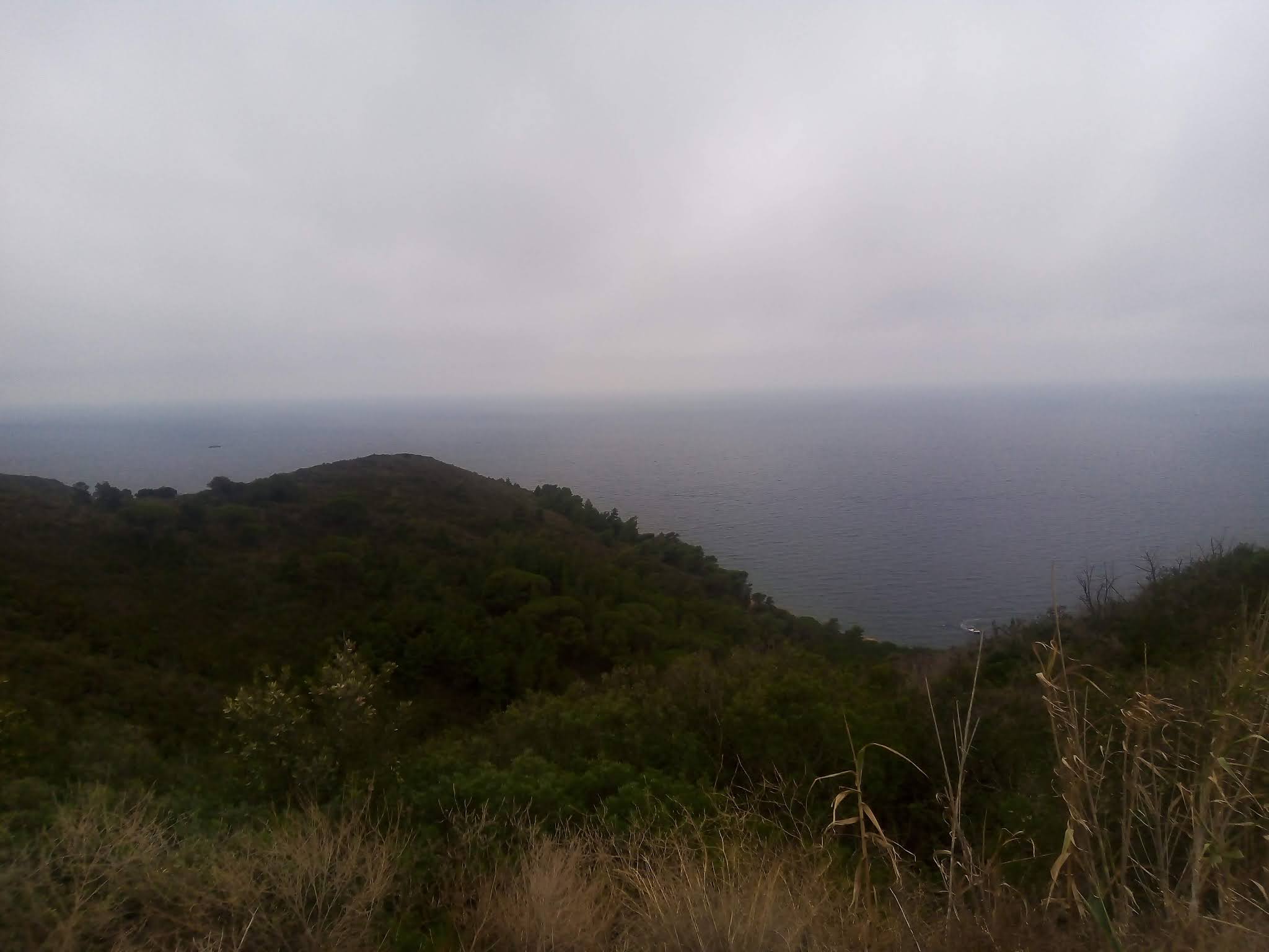
Panoramic view towards the sea


 I am nearing the end of the adventure now, but the hills are certainly not lacking! I pass Colle la Foce, and the trail in this stretch is truly uneven, with huge boulders that seem like disorganized steps. Another long stretch and I reach a new repeater on Monte Tambone (377m), where I take a forced break to eat and, most importantly, to recharge my precious GPS with a backup battery. I take the opportunity to make a phone call as well. About 20 minutes pass, and the watch battery is alive again. I pack everything back into the backpack and resume the journey shrouded in fog. A steep descent begins, and I start to see my beach (Lacona) in the distance, and at the far end, Capoliveri beach. I don't stop anymore; I take the wrong path once again for about 600m, but it's not a big deal, and I quickly get back on the right track.


Visual to sea


The coast in the distance


I thus reach the main road, position myself on Lacona's bike path, and cross it all. Climbing towards the campsite, I record the last video. In 12 hours and 20 minutes, I complete this adventure, not very long but very concentrated in elevation changes, in fact, it is 41km with a total of 5106m of elevation gain! Ritual photo in front of the camper, and then a well-deserved rest. I must say that the old foundations created with the Mono-training strategy for ultratrail have effectively shown themselves... Very satisfied, also because, in a life of long-distance walking, my knees are still healthy, which is rare even due to age limits!


Arrival


On a future occasion, it will definitely be necessary to do the tour on the other side of the island with Portoferraio, Monte Calamita, etc...

YOUTUBE LIVE VIDEO, TO VIEW IT FOLLOW THE LINK:  

https://youtu.be/L31y6SQ7M8E


Cartographic detail ViewRanger: 

https://my.viewranger.com/track/details/MjAxNjM3ODA=  


Below is the detail of the reference links related to my ultratrail and trail articles:
 
 Very long distances | Routes | Competitions | Solo adventures | TRAVEL TRAIL | Publications | Training strategy |
UltraTrail eBook |
HOME


domenica 25 luglio 2021

TRAVEL TRAILER: Tra i colli dell'isola d'Elba

In cima al Monte Capanne

Panoramica a 360° dal Monte Capanne


L'evoluzione ormai è scontata, tra i mille posti che ho potuto raggiungere sempre partendo da casa a piedi credo di essere arrivato ad un limite perché non mi resta più molto di interessante da esplorare sempre col via dall'abitazione. Quindi con questa avventura do il inizio ad un nuovo modo di fare lunghe percorrenze a piedi, trasformando questa passione in TRAVEL TRAILER, perché il posti al mondo da visitare a piedi su distanze imponenti sono tantissimi, infiniti!

Tour Isola d'Elba da Lacona a M. Capanne


Veniamo alla percorrenza all'Isola d'Elba. Il giro si è svolto il 24 luglio 2021 con partenza alle ore 5.45, dal camping Stella Mare di Lacona(lido Capoliveri). Quindi è iniziata la percorrenza seguendo il tracciato realizzato la sera prima al computer e caricato sul GPS da polso. Per me il GPS da polso è uno strumento insostituibile che mi permette di cimentarmi in escursioni mai viste o provate prima in modo abbastanza immediato ed agevole. L'utilizzo sul posto di una vecchia cartina ogni volta che si ha un dubbio sul tragitto interromperebbe troppo spesso la percorrenza e diventerebbe difficile restare entro tempistiche accettabili.

Il tour dell'Isola d'Elba fatto in direzione Monte Capanne si è presentato subito tortuoso e ricco di salite ripide su sentieri poco scorrevoli, ricchi di massi e profondi solchi lasciati da moto e dallo scorrere dell'acqua piovana.

Al principio dopo una brevissima illusione di 'velocità' mi sono trovato di fronte alla prima ripida salita e poco male quando sei ancora fresco e pieno di energia superi in scioltezza tutte le difficoltà. Il bello però viene dopo.. Superata la piccola pianura di zona Lacona inizio la ripida salita verso il Monte Barbatoia(359m), passando da Serra del Pero. Raggiunta la cresta, in questo punto si intravvedono tra gli alberi i due versanti di mare agli opposti del isola. Vado avanti e costeggio la cima del Monte San Martino(370m) con una progressiva direzione in salita. Sono sulla GTE(Grande Traversata Elba). Raggiungo il sito montano 'Costa del Gualdarone' e le foto volano. Da qui inizio a perdere quota con una discesa abbastanza scorrevole, una delle poche dove riesco a correre su sentiero. Arrivo all'abitato e mi trovo in località Literno, costeggiando su un sentierino pianeggiante la 'Via per Portoferraio', con un imprevisto sul percorso: un cancello bello grosso nel bel mezzo di una strada segnata sulla carta! Lo scavalco.

Areoporto di La pila visto dai colli

Monte Capanne in lontananza

Tipico Tratto di sentiro ripido dissestato


Inizia una nuova salita passando per Vigne Giunche seguendo lo sterrato per 'Via dei forcioni' fino a Poggio San Prospero(402m). Da qui inizia un fitto bosco con una ripida salita che mi porterà sul Monte Perone(603m), Luogo stupendo ma rovinato dai grossi ripetitori telefonici(realtà diffusa su molte cime dell'isola). Poi attraverso un luogo adibito ai picnic, con molti tavoli e un piccolo rifugio in legno chiuso. Guadagno ancora quota e arrivo al Monte Maolo(750m) e poco dopo scordo ad un bivio di controllare il GPS e sbaglio strada dirigendomi per un buon chilometro in salita verso il Monte Le Calanche(che incrocerò al ritorno) e mi rimetto sulla via tornando indietro. Sono al limite della vegetazione isolana e iniziano lunghi tratti di impervie pietraie al bordo del dirupo. Salgo ancora e qui arrivano le vie ferrate ai piedi della cima del Monte Capanne(1019m) che con un po' di arrampicamento ne raggiungo la vetta. Là ci sono molte persone e scopro da li a poco anche il motivo: è presente un cestellovia. Arrivato su mi siedo sul masso più alto di tutti e inizio con qualche ripresa e foto panoramica. E' bellissimo osservare il mare tutto intero e vedere nettamente il contorno di tutta l'isola. L'Italia da un lato, L'isola Capraia e altre isolette dell'arcipelago Toscano. Panorama mozzafiato, sembra di essere in cima al mondo su questa piccola Isola d'Elba! Vado alla ricerca del Bar ma è chiuso, un po' di sconforto perché mi resta meno di mezzo litro d'acqua in borraccia. Passo cosi da un sorso ogni 30 minuti ad un sorso ogni ora. Non è facile resistere ed andare avanti nonostante tutto, il caldo è forte(stimo 35 gradi) ed il sole picchia.

Dopo il Monte Capanne intraprendo la via del ritorno, che è differente da quella dell'andata, più impervia. Ripercorro le ferrate ed inizio una fitta serie di altre cime consecutive. Quindi sulla cresta attraverso molti massi proseguo lentamente ma con molta attenzione ai pericoli, raggiungo il Monte Calanche già citato prima(905m) e sempre sulla cresta arrivo alla cima del Monte Tiratoio(810m). Da questi colli vedo valloni da un lato che vanno verso il mare e un profondo dirupo dall'altro lato. Attraverso una ripida pietraia e raggiungo Masso della Quata(746m), luogo secchissimo dove però scorgo delle antiche costruzioni in pietra, rinforzate in tempi più recenti credo con cemento armato. Qui trovo anche delle coppelle che forse sono state realizzate dall'uomo per raccogliere la poca acqua piovana. Vado avanti per svariati chilometri e la temperatura diventa insopportabile. Solo cespugli secchi e pungenti ma qui in qualche tratto riesco a correre anche se sono molto disidratato.


Foto a 180° durante la salita

Indicazioni varie


Resisto ancora un po' ed arrivo nel primo paesello dalla discesa dal Monte Capanne e trovo la tanto desiderata fontana a San Piero di Campo(250m) e mi butto letteralmente sotto, bevo non so nemmeno io quanto, riempio le borracce, mangio qualcosa. Attraverso lentamente il paese perché dopo tutta quell'acqua tutta insieme so che è meglio aspettare a correre, pena problemi di stomaco... Succede spesso agli atleti poco esperti. Dopo una ventina di minuti riabbraccio brevemente l'asfalto e riprendo a corricchiare, poi nuovamente su sterrato, trovo una bella Chiesetta che fotografo senza fermarmi troppo. Incrocio il fiume asciutto Fosso del Bovalico ed entro in un nuovo comune(Marina di Campo), ormai sono sulla costa al livello del mare.


Chiesetta tra San Piero e Marina di Campo

E' strano come in una situazione marittima si guadagna e si perde dislivello, spesse volte si arriva a livello zero(sul mare), una situazione insolita per chi come me, è abituato alle alte quote alpine della Valle Po. Era già un po' che sognavo un bel caffè e una bottiglietta di acqua frizzante. Così proseguo lungo la costa e scruto i locali alla ricerca di una bar. Trovo un chioschetto pieno di gente e mascherina in viso mi fermo, così approfitto per raccontare la mia avventura alla barista e colgo l'occasione per chiede qualche informazione sul tragitto che mi resta. Mi gusto il tutto seduto a un tavolino da tranquillo e poi riprendo a sgambettare a buon passo corrichiando, attraverso la poca pianura presente e riprendono in men che non si dica le salite, ripidissime tanto per non perdere l'abitudine.

Visuale


Sono verso la fine dell'avventura ormai ma i colli non mancano affatto! Oltrepasso Colle la Foce, il sentiero in questo tratto è davvero disconnesso, massi enormi che sembrano scalini disorganizzati. Ancora un lungo tratto e raggiungo un nuovo ripetitore sul Monte Tambone(377m), qui faccio una pausa forzata per mangiare e soprattutto per ricaricare il mio preziosissimo GPS con la batteria tampone. Approfitto per fare anche una telefonata. Passano circa 20 minuti e la batteria del orologio ha di nuovo vita nuova. Ritiro tutto nello zaino e riprendo il tragitto avvolto dalla nebbia. Inizia una copiosa discesa ed inizio a vedere in lontananza la mia spiaggia(Lacona) ed in fondo il lido Capoliveri. Non mi fermo più, sbaglio strada ancora una volta per circa 600m ma poco male e riprendo subito la via giusta.

Vista verso il Mare

La costa in lontananza


Raggiungo così lo stradone, mi posiziono sulla ciclabile di Lacona e attraverso tutto. Salita verso il campeggio e intanto registro l'ultimo video. In 12 ore e 20 minuti termino questa avventura non lunghissima ma molto concentrata nei dislivelli, infatti sono 41km con ben 5106m di dislivello complessivo! Foto di rito davanti al camper e poi meritato riposo. Devo dire che le vecchie basi create con la strategia del Monoallenamento per l'ultratrail non hanno mancato di manifestarsi efficacemente... Molto soddisfatto, anche perché in una vita di lunghe percorrenze a piedi le ginocchia sono ancora sane, cosa che anche per limiti d'età è rara!

Arrivo


In una prossima occasione sarà sicuramente da svolgere il tour sull'altro versante dell'isola con Portoferraio, Monte Calamita, ecc...

VIDEO YOU TUBE LIVE, PER VISUALIZZARLO SEGUI IL LINK:

https://youtu.be/L31y6SQ7M8E


Dettaglio cartografico ViewRanger:

https://my.viewranger.com/track/details/MjAxNjM3ODA=


Segue il dettaglio dei link di riferimento riguardo ai miei articoli ultratrail e trail:

Lunghissime distanze | Percorsi | Gare | Imprese | TRAVEL TRAIL | Pubblicazioni | link utili | Strategia d'allenamento |

Libro UltraTrail | Forum | Affiliazione


Cerca nel blog