sabato 12 luglio 2025

Vinadio-Sambuco e ritorno - 30km complessivi in Valle Stura


Oggi(sabato 12-07-2025) è stata un’uscita particolare... Volevo partire da Vinadio per raggiungere il Rifugio Gardetta, ma il percorso si è rivelato ingannevole. Infatti, ho completamente sbagliato il punto di partenza: la distanza per raggiungere Sambuco, il comune ai piedi del sentiero per la Gardetta, era davvero notevole, ben 17 km di avvicinamento! Ciò mi ha scoraggiato molto per il raggiungere il mio obbiettivo primario.

Ho persino sbagliato strada, imboccando per errore la direzione verso San Pietro Porzio, lungo la strada di mezza montagna che stavo percorrendo. Il ritorno, fortunatamente, è stato più agevole, con meno errori di percorso.


Ho lasciato l’auto presso il forte con bar di Vinadio, nel grande parcheggio dove ci sono sempre molti camper. Ho intrapreso la mia escursione verso le 7:30 circa del mattino. Ci tengo a sottolineare che arrivare fin lì da Envie è davvero lungo in macchina!

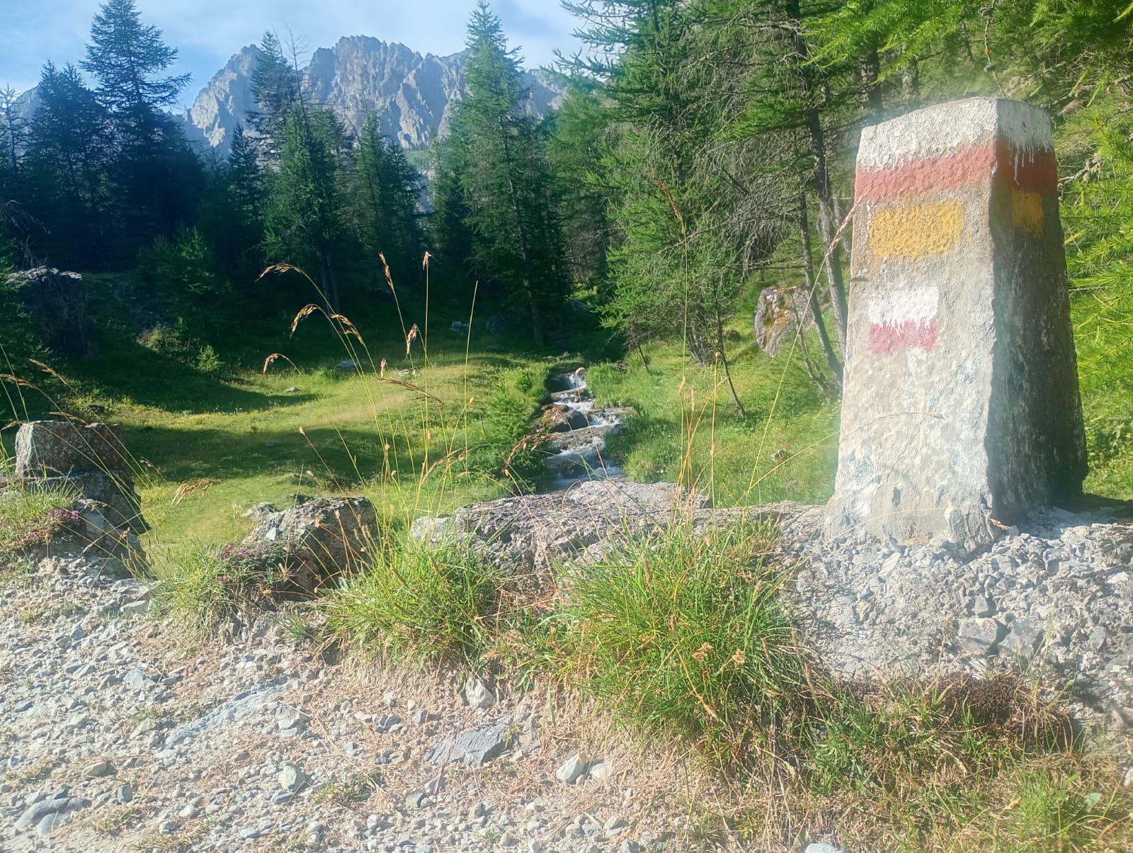
Dopo un tratto di stradone sulla sinistra, ho imboccato i prati lungo il fiume, seguendo sentieri appena visibili perché molto sporchi, segnati solo da qualche traccia di vernice su alcuni massi. Da lì si raggiunge lo stabilimento di Pratolungo. Seguendo parte del suo perimetro, si arriva a una strada asfaltata di mezza montagna, forse un residuo militare. Si sente poco sotto lo scorrere dello Stura, in contemporanea al rombo dei veicoli sullo stradone.
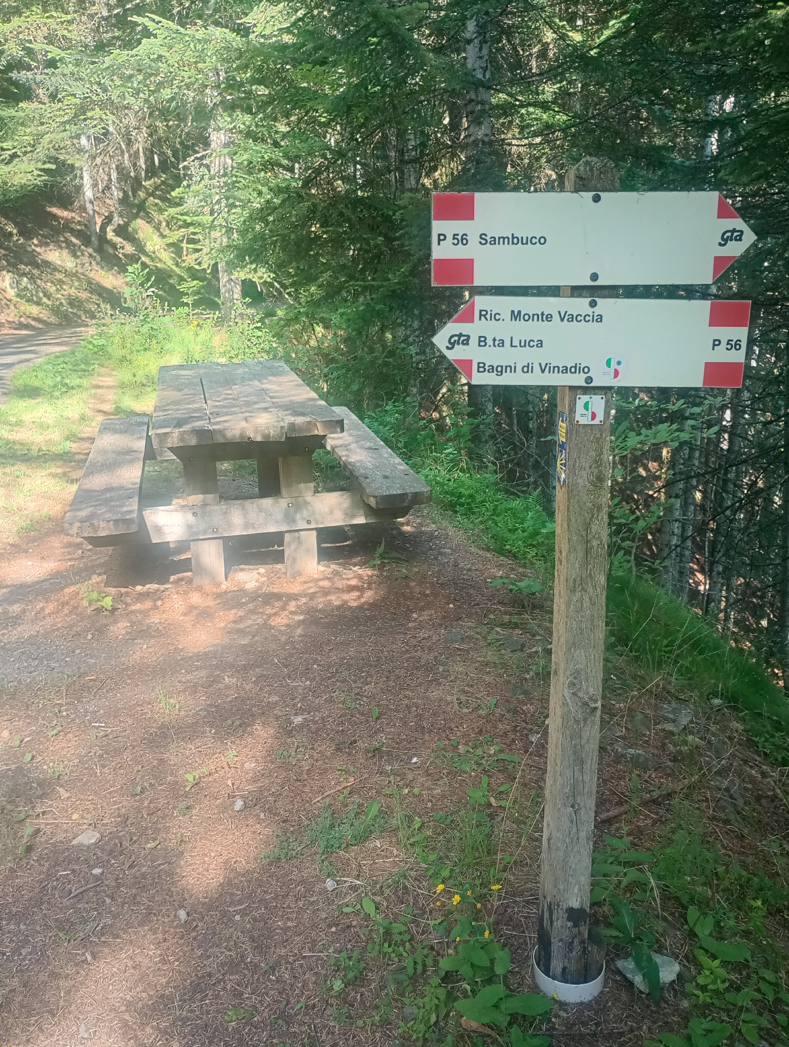


Ho imboccato questa via che si è rivelata una salita costante per quasi tutto il tempo. Un errore importante è stato quello di tenere la sinistra al bivio, scegliendo l’asfalto, non proprio la mossa più saggia! Infatti, a quel bivio, che non presenta alcuna indicazione, sarebbe stato meglio scegliere la sterrata a destra, che consente di evitare chilometri inutili e raggiungere Sambuco più rapidamente. Da lì parte una discesa decisa che accorcia il tragitto di circa 3 km.

Se invece si resta sull’asfalto proseguendo verso San Pietro Porzio, il tratto è in costante salita e si finisce per superare ampiamente l’abitato, per poi tornare indietro lungo un tratto finalmente in discesa.


Si attraversa lo Stura, con la montagna alle spalle di Sambuco ben visibile: il Monte Bersaio, con i suoi oltre 2300 metri. All’interno del paesino non ci sono negozi, solo un albergo e un bar-ristorante nella piazza principale. Una pausa caffè qui è d’obbligo. Ho scambiato qualche chiacchiera con il gestore riguardo al miglior percorso per raggiungere il fantomatico Rifugio Gardetta, che visiterò la prossima volta, e sono rientrato verso Vinadio. Stavolta ho imboccato subito la strada giusta, rendendo il tragitto più breve e con meno dislivello. Ben arroccata ed interessante la Chiesa del Roccassio, tipica di montagna.


Tra caffè, foto e deviazioni, ho impiegato 5 ore e 44 minuti per l’intero percorso, con uno sviluppo di circa 30 km e un dislivello positivo di 600 metri. Quindi: 17 km all’andata e 13 al ritorno. L'orario di arrivo all'auto è stato circa alle 13.45 al parcheggio di Vinadio.


La prossima volta, per raggiungere il Rifugio Gardetta, inizierò dai pressi di Sambuco, dove parcheggerò l’auto e proseguirò a piedi lungo il sentiero, riducendo così i chilometri all'essenziale. Questo mi permetterà di collegarmi al tratto precedente, da Acceglioal Rifugio Gardetta, che ho completato la settimana scorsa!


Anche questa percorrenza è stata messa in atto con la Tecnica del Monoallenamento Settimanale:

http://www.bertinettobartolomeodavide.it/ultratrail/index.html


Percorrenza GPS:

https://www.komoot.com/it-it/tour/2397737325?share_token=aj5c8ScZezdgUNcthkM3O02T6NuffW1ZltF6GNiPbbuzpF5JjR&ref=wtd


Segue il dettaglio dei link di riferimento riguardo ai miei articoli ultratrail e trail:

Lunghissime distanze | Percorsi | Gare | Imprese | TRAVEL TRAIL | Pubblicazioni | link utili | Strategia d'allenamento |

Libro UltraTrail


domenica 6 luglio 2025

Tra i due versanti della Valle Maira: Bivacco Carmagnola e Rifugio Gardetta, passando da Acceglio


Ho esplorato, in diverse uscite, la splendida Valle Maira: un mondo a parte, incastonato tra le montagne della provincia di Cuneo. Tra la Valle Po e la Stura si trovano svariate vallate, ma osservare la Maira porta il pensiero verso monti estranei alle nostre zone.

In particolare, nel vallone le cascate di Stroppia! Già poco dopo il Bivacco Carmagnola si intravedono, seppur piccole in lontananza, si percepiscono maestose oltre misura. Sprigionano nuvole di vapore grazie ai numerosi metri di caduta dell’acqua, che appaiono appena ci si avvicina.

Scendendo dal Colle di Bellino, che si aggira attorno ai 2900 m, si apre un enorme canalone di origine glaciale, come una guida naturalistica ricorderebbe puntualmente.


Il sentiero dopo il Bivacco Carmagnola è agevole: consiglio però di non scendere lungo la mulattiera militare sterrata verso Acceglio, ma di percorrere la Valle di Mourin seguendo il relativo fiumiciattolo. Chilometricamente i due percorsi si equivalgono, ma il panorama è completamente diverso. A giugno il sentiero appare pulito, neve non se ne vede. Durante la discesa sarà necessario attraversare in alcuni punti il rigagnolo Mourin, ma nulla di impervio: spesso basta appoggiare i piedi sui massi per oltrepassarlo.

Si incontrano vari piccoli gruppi di baite radunate, ed altre isolate, tutte in buono stato di conservazione. Proseguendo si passa quasi sotto le già citate cascate di Stroppia, luogo magnifico, e si scende ancora verso Chiappera, dove è possibile parcheggiare l’auto. La distanza a piedi tra il Colle di Bellino e la zona del Rifugio Campo Base è di circa 10 km.


Giunti qui, dopo una meritata pausa al rifugio, si prosegue in discesa verso Acceglio, per poi risalire percorrendo la Valle di Unerzio, forse la zona più bella di tutta la Valle Maira, fino a raggiungere Chialvetta, con la sua Chiesetta che lascia intravedere il maestoso campanile della borgata.


Ancora avanti, osservando da lontano il vallone che si restringe, si possono immaginare meravigliosi luoghi d’alta montagna. Il dislivello, certo, non manca.

Dopo un paio di chilometri da Chialvetta si raggiunge Viviere, un altro borgo che merita di essere visitato, con tutte le sue baite ben restaurate, anche grazie all’influenza di turisti tedeschi. Qui, a ridosso della strada, si trovano baite dove è possibile richiedere affitti brevi e pernottare in luoghi di raro incanto (contattatemi!).

La strada si trasforma in mulattiera e poi in sentiero. A un certo punto si vede un bel Pilone Votivo e si apre una grande fattoria(Prato Ciorliero e Grangie Calandra) che sfrutta un intero pianoro, salendo verso la Gardetta: si tratta dell’ultimo baluardo di “civiltà” in questa zona.


Il sentiero diventa ripido e stretto, abbastanza frequentato e adatto anche alla percorrenza in bicicletta, sebbene a tratti sia tecnico. Nulla di difficile, invece, se affrontato a piedi.

Si raggiungono alcune fortificazioni militari che sono state parzialmente distrutte poiché distano a meno di 15 km dal confine (come mi ha insegnato una guida naturalistica!). È possibile visitarle, con la dovuta prudenza.


Da qui si raggiunge un altopiano, da cui si intravede un colle di circa 2800m di fronte ovvero Rocca La Meja, che sembra esotico: ricorda qualche lontano colle della Patagonia. Vale la pena fermarsi a scattare una foto mentre si è sul valico della Gardetta.


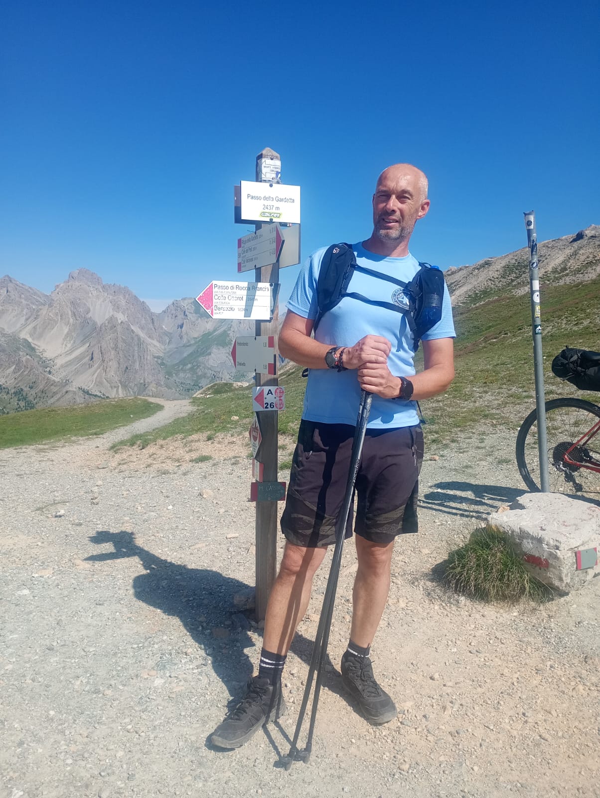
Dopo circa 500 m e un po’ di dislivello perso, si raggiunge il Rifugio Gardetta, locale perfettamente equipaggiato, dove è possibile concedersi un meritato momento di riposo. (Specifico la gentilezza del personale e la possibilità di gustare un buon caffè a solo 1 euro, cosa rara nel 2025!). Da Acceglio a qui sono circa 11 km e 1400 m di dislivello positivo.


Da questo punto inizia una poderosa discesa verso Vinadio lasciando la Valle Maira per entrare nella Valle Stura., che descriverò più avanti, dato che in questa occasione sono dovuto tornare ad Acceglio per il recupero dell'automobile parcheggiata.


Concludo scrivendo che questa Valle è anche la terra natale del pittore Olivero Matteo


 Mappa GPS:

- (26-06-2025) Campo Base(Chiappera) - Bivacco Carmagnola: https://www.komoot.com/it-it/tour/2367158542?share_token=asLIpqC6djjaJd6UvcyI9eWOFaA0SgD17iT8z0nRsENvjVi85n&ref=wta 

 - (06-07-2025) Acceglio - Rifugio Gardetta: https://www.komoot.com/it-it/tour/2383491766?share_token=aKW5BsIdv01oGB2eGJtZBcQzIjl22pdhyKpilo6Nx1aS6Yn5PZ&ref=wta 


Video YouTube LIVE, di entrambi i tragitti:


Anche per le due uscite qui descritte è stata usata la Tecnica del Monoallenamento Settimanale:

http://www.bertinettobartolomeodavide.it/ultratrail/index.html#google_vignette 


Segue il dettaglio dei link di riferimento riguardo ai miei articoli ultratrail e trail:

Lunghissime distanze | Percorsi | Gare | Imprese | TRAVEL TRAIL | Pubblicazioni | link utili | Strategia d'allenamento |

Libro UltraTrail


lunedì 16 giugno 2025

Between Pian Muné and Sant'Anna di Bellino – 52 km with +1580m elevation gain – Weekly Single-Workout Technique


I planned this walking adventure from Pian Muné to Sant'Anna di Bellino in preparation for a future project taking shape this summer.

So, I set off at around 6:30 AM on Sunday, May 11, 2025, heading toward Rifugio Bertorello, which I reached shortly afterward by following the beautiful mule track accessible to vehicles.

The route begins with a gentle incline that stretches for about 2 km, then continues along the ridge of the mid-mountain toward Pian Pilun for another 4 km. At one point, the ascent becomes steeper as it passes through a dense pine forest.


Heading toward Col del Prete, after the junction with Gilba, I kept to the right and continued along a new, continuous gentle incline for several kilometers.

Upon reaching the curve near the road to Becetto, the ascent remains fairly steady, with an elevation gain of several hundred meters—though the difficulty remains relatively moderate.


After reaching Col del Prete, I took a quick break for a snack.

Then began a steady descent toward Becetto, stretching several kilometers, which cost me all the elevation gain I had achieved. Upon arriving in Becetto, after traversing mule tracks, trails, and paved roads, I treated myself to another short snack break.

At this point, I still had several hours of walking ahead, and fatigue had yet to set in. My body felt fresh, but hunger was starting to become persistent. I tried to keep my appetite in check, knowing that a rushed digestion could potentially impact my journey—perhaps a hasty breakfast that morning before setting out was partly to blame.


I continued descending toward Sampeyre and stopped for my first coffee in the town center.

At the counter, I had the pleasant surprise of running into an old friend with whom I collaborated years ago at the Paesana swimming pool—good times!

Step by step, I had already covered 18 km, but the remaining distance was still significant. So, I resumed my journey along the mule track running beside the Varaita stream, which flowed wild and fast, as I made my way toward Casteldelfino.

Once in Casteldelfino, I headed to the Libreria Alpina of Fusta Editore, but unfortunately, it was closed for lunch break. So, I took another coffee break at a unique mountain bar, a place with a multifaceted soul—gas station, café, grocery store, and newsstand all in one! Absolutely fantastic, just the kind of spot I love.


Meanwhile, the weather was changing, and a little farther ahead toward Bellino, the sky grew increasingly darker.

As I ascended toward Bellino, the landscape unfolded into a breathtaking spectacle—high-altitude mountains, abundant snow, isolated hamlets, grazing cows, and countless flowers.

The climb continued relentlessly between Pian Muné and Sant’Anna, making the pace rather slow. A long and steady ascent still separated Casteldelfino from the 30th kilometer and Sant’Anna di Bellino from the 40th.

At this point, I decided to stop at Rifugio Melezé, where last year I had given a PNRR school conference on astronomy alongside my friend Sergio. Here, I indulged in a small snack—an exquisite chocolate and raspberry cake paired with a cappuccino, the perfect reward for the journey’s efforts.

At the Rifugio, they asked me where I was coming from, and, in disbelief, they listened to my story about the route I had taken.


Just under a kilometer, and I reached Sant’Anna—I had finally arrived at the final destination.

A place rich in memories of summers spent in the mountains with my daughters when they were still little, staying at the colony, which each year hosts dozens of children and teenagers, sponsored by the Church.

A few drops of rain mixed with hail on the return, but nothing concerning. Shortly afterward, I took the opportunity for a car ride back home, beyond the town of Casteldelfino.


 I conclude by saying that the pace was truly calm (slow), with stops for photos, videos, snacks, and long gazes at the breathtaking mountain landscapes between the Po Valley and the Varaita Valley.

It was almost entirely an uphill route, interrupted only by gentle inclines—except for the descent between Col del Prete and Sampeyre.


The choice to maintain a slow pace proved wise, driven by energy conservation.

Overall, I covered just over 52 km in 11 hours and 25 minutes, with 1,580 meters of elevation gain. The route was highly scenic, with few opportunities for running due to the continuous ascents.

For this outing as well, I followed the guidelines of the Weekly Single-Workout Technique, described in the book UltraTrail con il Monoallenamento, published by Fusta Editore.


GPS route on Komoot, from Garmin Fenix 7:

https://www.komoot.com/it-it/tour/2235710694

Live video of the journey between Pian Muné and Sant'Anna di Bellino


Below is the detail of the reference links related to my ultratrail and trail articles:

Very long distances | Routes | Competitions | Solo adventures | TRAVEL TRAIL | Publications | Training strategy |
UltraTrail eBook |


48.5 km from Envie, through the Saluzzo hill, Manta hill, Verzuolo hill, and back – Weekly Single-Workout Technique

After reflecting on which route to take during one of my free days coinciding with the Easter break, I decided on a hike through the hills of the Saluzzo area—also as a continuation of my previous walking trip in the historic part of Saluzzo's hill.

The departure was set for 8:15 AM on Tuesday, April 22, 2025, equipped with a backpack and trekking poles. My Garmin Fenix watch, with a GPS track for navigation, provided me with a clear path to follow.

The most "tedious" part was the approach to Saluzzo, but as soon as I reached the beginning of the first climb towards the hill, everything changed—the landscape became rich with details to observe.

I crossed the entire hill, passing in front of Casa Cavassa, and eventually emerged near the Palazzo di Città. My first stop for a quick snack was in front of Castiglia, where I paused for just under five minutes.

Continuing along the hill, I headed toward Manta, where at one point I merged onto the bike path. I reached the center of Manta and then made my way toward Via Santa Brigida, heading into a steep ascent.


I move forward step by step until I reach the Chapel of San Leone, where I pause for a quick exploration and to fill up my water bottle.

This is the first of the three "silent" chapels I come across on this hilly adventure. I continue for a few kilometers, suddenly finding myself deep in the dense forest! Dirt roads and pathways roll beneath my shoes until I reach the first major "obstacle" of the day—a private property. I manage to bypass it somehow and reconnect with the public trail.

A few more kilometers of climbing take me toward the Verzuolo woods, where I encounter another private property. I navigate around it once again, losing quite a bit of time in the process.

After overcoming this hurdle, I finally reconnect with the planned route. Along the way, I unexpectedly step over a small viper basking in the sun!


After a few kilometers through the forest, I spot the Chapel of Santa Cristina in the distance, standing alone in the greenery.

Here, I take another quick snack break and take advantage of a fountain to refill my water bottle—water is always a precious resource not to be wasted, as it can often be many kilometers before finding another source.


From Santa Cristina, a remarkable descent begins, leading me to the third significant chapel of this beautiful ultratrail journey: San Bernardo.

At San Bernardo, an absolute silence reigns. I explore the area, capturing a short video. What stands out is the presence of the religious house adjacent to the chapel—I wonder who was the last priest to have actually spent the night there.

Looking up at the small bell tower, I immediately notice a sundial with a Sun drawn to the side, a peculiarity I had never seen anywhere else before!


From this point on, it's all downhill to Verzuolo, where I take a coffee break at a bar (a little longer than usual!), before setting off again along the bike path toward Saluzzo, passing through Manta once more.

I find myself admiring the historic streets and houses, until I finally complete the crossing of Saluzzo.


The most "tedious" stretch remains the one through the countryside separating Saluzzo from Envie (both on the way there and back): long, monotonous straight roads, plus the extended section required to circumnavigate the Po River and reach the bridge that connects me to Via Vecchia Barge. Unfortunately, this adds quite a few kilometers to my route.

Throughout the journey, I was able to appreciate the details of the chapels I encountered, with special praise for San Leone and San Bernardo, without taking anything away from Santa Cristina, which I had never visited before.

This excursion is part of my new passion for the hills of the Saluzzo area and its historic center.

As for the numbers, it covered 48.5 km in 9 hours and 15 minutes, with a positive elevation gain of 800 meters—an adventure made possible by the Weekly Single-Workout Technique, described in the book published by Fusta Editore, Ultratrail con il Monoallenamento.


Video LIVE YouTube:


Below is the detail of the reference links related to my ultratrail and trail articles:

Very long distances | Routes | Competitions | Solo adventures | TRAVEL TRAIL | Publications | Training strategy |
UltraTrail eBook |


Cerca nel blog