E' incredibile come la tecnica del Monoallenamento settimanale funzioni bene per ogni branca dell'allenamento rivolto alla lunghissima resistenza! Vi propongo qui la nuova avventura ibrida Bici/Trail, svolta in Valle Pellice...
Rifugio Jervis
Panorama Pra
Cascata sul percorso
In effetti non è da molto che sono arrivato ma ho deciso di sedermi per scrivere subito un pezzo riguardo all'avventura ibrida bici/trail di oggi, domenica 11 settembre 2022. Si avete letto bene, ho scritto anche la parola 'bici' dato che come alcuni anni fa ho ripetuto questa esperienza su un nuovo itinerario.
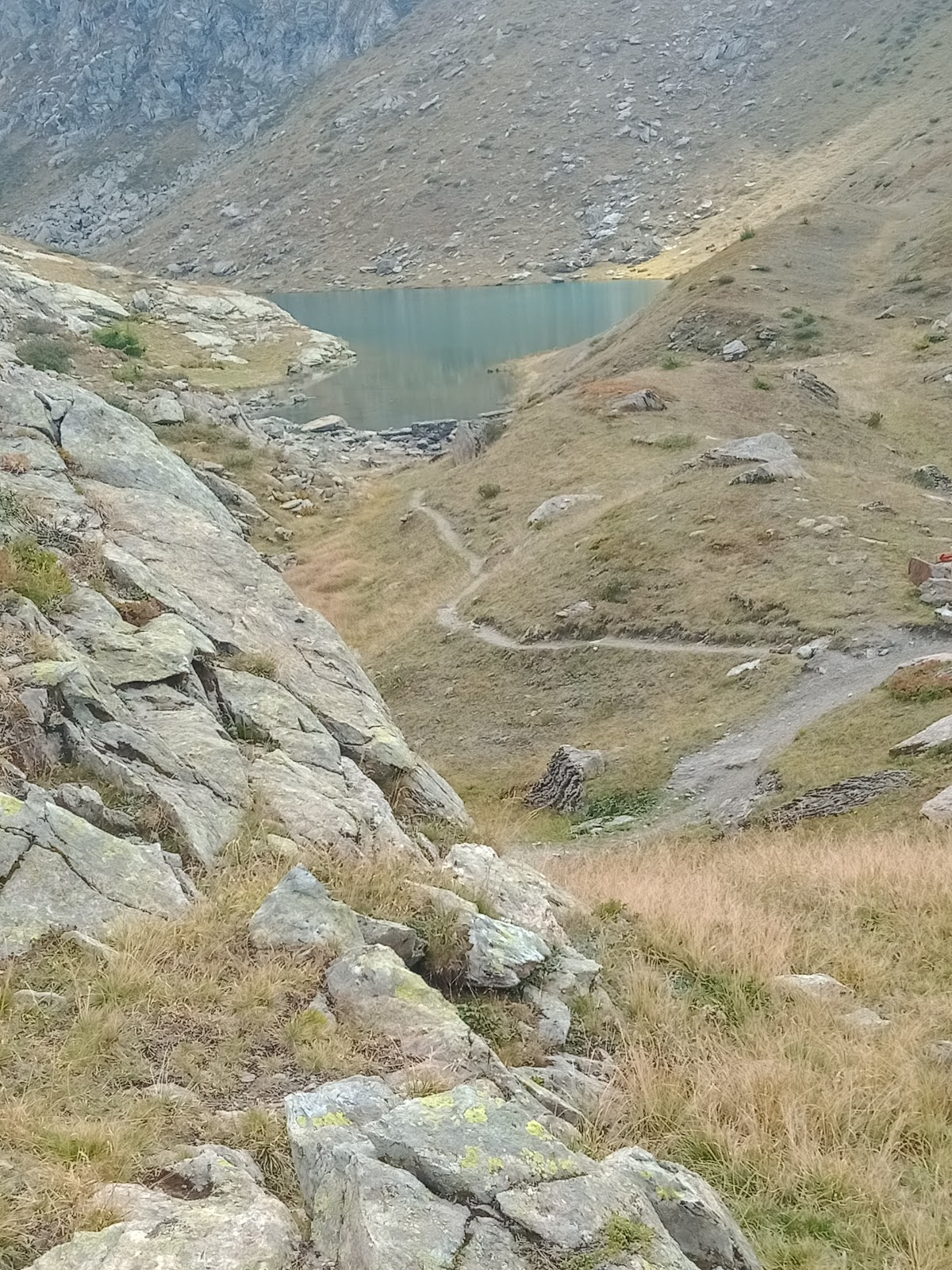
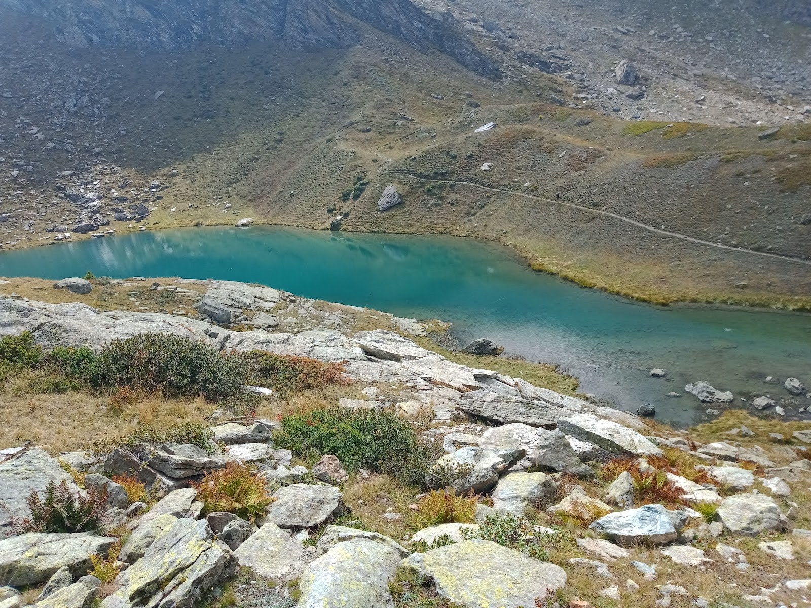
Lago Granero
Colle tra valle Po e Pellice
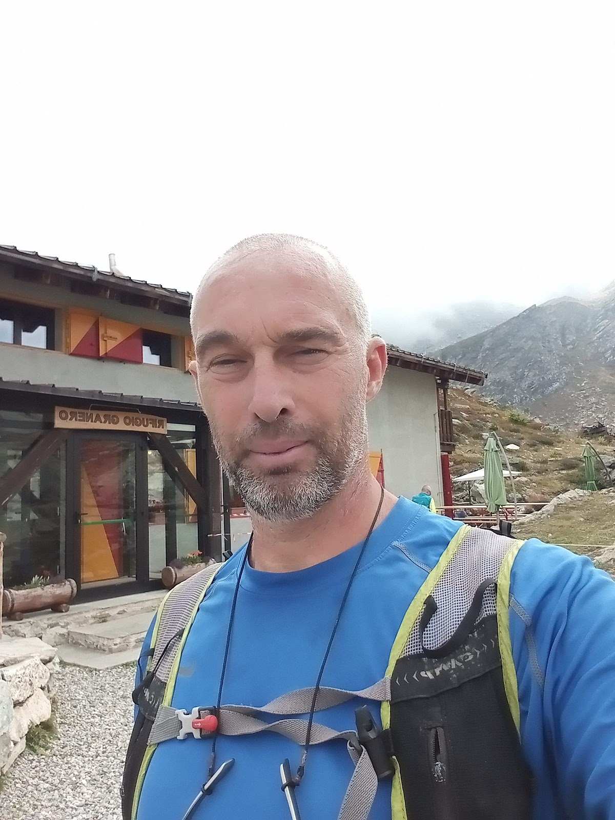
Rifugio Granero
Tanti anni fa, quando ero ancora piccolo, diciamo a 7 o 8 anni partivo con il mio amico Paolo per le delle 'scorribande' nelle campagne vigonesi e 'sparivo' con la mia biciclettina nel vero senso del termine. Inutile scrivere che la mia famiglia si allarmava in modo incredibile ma già allora ero probabilmente 'fatto male', le cose oggi che mi avvicino sempre di più ai 50 anni non sono cambiate!
Ho pensato tutta la notte se fare o non fare questa 'peripezia' oggi. Alla fine ho deciso di NON uscire, tuttavia tanto per contraddirmi la testardaggine appena sceso dal letto ha preso il sopravvento e in men che non si dica ho preparato lo zaino, il cibo, la bicicletta e sono partito... Avrei avuto da andare avanti con la preparazione dell'esame molto imminente di odontoiatria ma niente, non voglio avere ripianti per le cose non fatte e dato che questa era l'ultima finestra per realizzare quello che mi frullava in testa, l'impuso è stato più forte di me e non sono riuscito a trattenermi.
Circa alle 8 del mattino sono saltato sulla bicicletta con zaino in spalla, bastoncini legati al telaio e scarponcini ai piedi. Ho pedalato per 42 km fino a Villanova, dopo Bobbio Pellice partendo da Envie. Il tratto tra Bobbio e Villanova era abbastanza in salita e anche se nelle ultime settimane ho completato giri in bici da 100km ad uscita, si trattava tutte le volte di pianura. Comunque è andata bene e sono arrivato pedalando fino al parcheggio di Villanova, legando il mio 'veicolo' ad una griglia in ferro con la speranza di ritrovare la bici al ritorno. Erano circa le 11.
Da quel punto ho iniziato a sgambettare a piedi, cosa che non avevo più fatto dal tour dell'Isola d'Elba. Quindi su per una salita continua verso il Pra, un luogo che mi affascina col suo rifugio Jervis, perché si tratta di una località completamente senza energia elettrica. Ogni casa ha il suo generatore o pannello solare, eppure ci sono margari che abitano lassù e vivono molto bene, credo meglio di noi nonostante tutte le comodità dell'urbanizzazione che abbiamo. Inutile scrivere che di domenica la gente non manca per tutto il tratto tra Villanova e Pra ma poi salendo oltre le cose cambiano molto! Infatti il pienone del rifugio Jervis è completamente diverso dal numero di persone presenti al rifugio Granero a quota 2380m.
42km mappa bici andata Envie-Villanova
Trail: Villanova-Colle Sellerie e ritorno 26km
Bici ritorno 42km Villanova-Envie
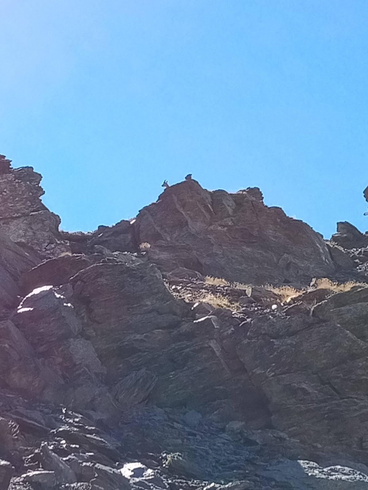
Dopo il Pra per raggiungere il Granero la salita è molto ripida e concentrata in pochi chilometri dove il passo si è fatto davvero lentissimo sotto il sole che picchiava, anche se le nuvole ad un certo punto hanno iniziato a comparire in modo preoccupante. Arrivato al rifugio poco dopo le 14, ho dovuto prendere un tanto desiderato caffè per soddisfare il mio solito rituale, aggiungo che il personale di questo locale è straordinario! Qui solo visitatori francesi. Proseguo verso il Colle Sellerie per altri 400 o 500m di dislivello, arrivando secondo le mie stime oltre i 2800m sullo spartiacque/confine tra Italia e Francia. Dal Granero il dislivello si 'impenna' decisamente. Le nuvole mi raggiungono e comincio ad essere pessimista sull'esito positivo dell'avventura dato che questo significa in mezzo alle montagne, essere avvolto dalla nebbia! Bé sono stato fortunato ed il cielo è rimasto limpido. Ho raggiunto il traguardo prefissato alle 15.20 e con sorpresa lassù c'erano una coppia di camosci(madre col suo cucciolo, credo) che non volevano saperne di andare via. Praticamente questi due animali sono rimasti a 10m metri da me per tutto il tempo mentre facevo il mio spuntino.
Camosci verso Colle Sellerie
Lago Granero
Sempre camoscio Colle Sellerie
Il panorama da quel punto era mozzafiato, c'ero già stato alcuni anni fa. Si vedeva il versante francese del Monviso, anche da lontano era ugualmente imponente. Poco sotto il rifugio Monvisò, molto distante. Guardando dal lato opposto tutti i colli più alti che contornano la Valle Pellice e le nuvole sotto di me. Di lato avevo la punta del Colle Sellerie, stupenda. Il tempo di girare un piccolo video, qualche foto e inizio la discesa ripidissima di quel tratto per il ritorno. I camosci non si curano più di me e stanno sempre lì. Il GPS indicava 13km di percorrenza partendo da Villanova.
Vado giù spedito, la velocità è più che raddoppiata nella discesa e mi fermo solo quando vedo fontane per riempire la borraccia, dato ho bevuto molto per tutto il rientro per via dell'enorme sudata a salire.
Superato il Granero continuo la discesa senza pause, arrivo in breve tempo al Jervis e inzio a pensare che se mi fermo di probabilmente cado nella notte. Per evitare il buio che avanza vado avanti spedito e sbaglio strada ad un bivio perdendo 10 preziosi minuti. Giunto nuovamente a Villanova decido di non fare lo spuntino previsto prima della bici e consumo al volo un secondo caffè nella Locanda, posto d'altri tempi, stupendo.
Monviso lato francese
Madre e cucciolo sullo spartiacque
Monviso lato posteriore panoramica
Preparo velocemente tutto e salto sulla bicicletta alle 18.30 per una 'folle' discesa fino alla rotonda di Bibbiana, al fine di 'combattere' il tempo che passa. Le auto iniziano ad avere gli anabbaglianti accesi e questo non è buon segno. Non smetto di pedalare e proseguo fino a Bagnolo, dove imbocco la ciclabile per la mia sicurezza. Il buio incombe e raggiungo Barge, così dopo sono obbligato a proseguire per un lungo tratto sullo stradone, è ancora giorno ma il sole non c'è più. Imbocco la mia solita strada 'via vecchia Barge' e mi avvicino a casa più tranquillo anche se non mollo con la velocità. Completo il ritorno in bici alle 20.09 per altri 42km.
Una gran bella avventura che dimostra ancora una volta l'efficacia del Monoallenamento sia nei confronti della bicicletta e del trail/ultratrail.
Valle Pellice sopra le nuvole
Colle Sellerie
Il tutto è durato 12 ore esatte, composte da 42km di bici per l'andata, 13km trail con salita continua a piedi e altrettanti di discesa, quindi altri 42km di ritorno in bicicletta. Un totale di 110km.
Bici con bastoncini legati al telaio
Partenza in bici da Villanova(ritorno)
Arrivo a casa, le feste di Lola
Ora mi riposo per i prossimi mesi, ho troppo da studiare e devo prendermi una pausa dallo sport per concludere il quinto ed ultimo anno di Osteopatia... Anche se sono in linea con gli esami devo dedicare tutto il mio tempo per raggiungere questo obbiettivo, consapevole che alla mia età l'apprendimento non è più così agile. Ripartirò sicuramente più avanti con tutte le mie chilometriche avventure!
Video Live dell'avventura:
Segue il dettaglio dei link di riferimento riguardo ai
miei articoli ultratrail e trail:
In fact it hasn't been long since they arrived but I decided to sit down and write a piece about today's hybrid bike / trail adventure, Sunday 11 September 2022. Yes, you read that right, I also wrote the word 'bike' since from a few years ago I carried out this experience on a new itinerary.
Granero Lake
Hill between the Po valley and Pellice
Refuge Granero
Many years ago, when I was still a child, let's say at 7 or 8 years old, I left with my friend Paolo for the 'escapes' in the Vigonese countryside to 'disappear' with my little bicycle in the true sense of the word. Needless to say, my family was incredibly alarmed, at that time I was probably already 'crazy', and today I'm getting closer and closer to 50 but I haven't changed! I've been thinking all night about whether or not to do this "adventure" today. In the end I decided NOT to go out, but only to contradict myself, the obstinacy just got out of bed took over and in no time at all and so I prepared the backpack, the food, the bicycle and I left ... I had to go ahead with my studies for the next university dentistry exam but nothing, I don't want to have regrets for things not done and since this was the last window to realize what I had in mind, the impulse was stronger than me. I couldn't help but hold you back. Around 8 in the morning I jumped on the bike with my backpack, sticks tied to the frame and boots on my feet. I cycled for 42 km to Villanova, after Bobbio Pellice starting from Envie. The stretch between Bobbio and Villanova was quite uphill and even if in the last few laps on the bike I covered 100 km per exit, I was always on level ground. However, it went well and they came pedaling to the Villanova parking lot, tying my 'vehicle' to an iron grate with the hope of finding the bike on the way back. It was about 11:00. From that moment on I started walking, which I hadn't done since the tour of the Island of Elba. Then continuously uphill towards the Pra, a place that fascinates me with its Jervis refuge, because it is a place completely without electricity. Each house has its own generator or solar panel, yet there are margari living up there and they are very well, I think better than us despite all the comforts of urbanization we have. It is useless to write that on Sunday all the stretch between Villanova and Pra there was a lot of people! In fact, the full house of the Jervis refuge is completely different from the number of people present at the Granero refuge at an altitude of 2380 m.
42km one way bike map Envie-Villanova
Trail: Villanova-Colle Sellerie and return 26km
Bike return 42km Villanova-Envie
After the Pra to reach the Granero the climb is very steep and concentrated in a few kilometers where the step became very slow under the scorching sun, even if the clouds at a certain point began to appear worryingly. Arriving at the refuge shortly after 2 pm, I had to have a much desired coffee to satisfy my usual ritual, I add that the staff of this place is extraordinary! Here only French visitors. I continue towards Colle Sellerie for another 400 or 500 m in altitude, arriving, according to my estimates, at over 2800 m on the watershed / border between Italy and France. From Granero the difference in height 'rises' decisively. The clouds reach me and I begin to be pessimistic about the positive outcome of the adventure since this means in the middle of the mountains, be being shrouded in fog! Well, I was lucky and the sky remained clear. I reached the goal at 3:20 pm and to my surprise there were a couple of chamois up there (mom with her cub, I think) that didn't want to leave. Basically these two animals stayed 10 meters away from me the whole time while I was having a snack.
Chamois towards Colle Sellerie
Lake Granero
Always Colle Sellerie suede
The view from that point was breathtaking, I had already been there a few years ago. You could see the French side of Monviso, even from a distance it was equally impressive. Just below the Monvisò refuge, very far away. Looking from the opposite side all the highest hills that surround the Pellice Valley and the clouds below me. On the side I had the tip of Colle Sellerie, wonderful. Time to shoot a small video, some photos and start the very steep descent of that stretch for the return. The chamois no longer care about me and are always there. The GPS indicated 13km of distance starting from Villanova. I go quickly, the speed is more than doubled in the descent and I stop only when I see fountains down to fill the bottle, since I drank a lot for the whole return because of the enormous sweat in going up. After passing the Granero I continue the descent without pause, I arrive in a short time at Jervis and I begin to think that if I not run stop in the night. To avoid the darkness that advances I go ahead quickly and take the wrong way to a crossroads, losing 10 precious minutes. Once back in Villanova I decide not to have the snack before the bike and I immediately consume a second coffee in the Locanda, a place of other times, wonderful.
Monviso French side
Mother and cub on the watershed
Monviso panoramic rear side
I quickly prepare everything and jump on the bicycle at 6.30 pm for a 'crazy' descent to the Bibiana roundabout, in order to 'fight' the passing of time. Cars start to have low beams on and this is not a good sign. I do not stop pedaling and continue to Bagnolo, where I take the cycle path for my safety. Darkness is looming and I reach Barge, so after I am forced to continue for a long stretch on the main road, it is still day but the sun is gone. I take my usual street 'via vecchia Barge' and I approach the house more calm even if I do not give up with the speed. Complete the return by bike at 20.09 for another 42km. A great adventure that once again demonstrates the effectiveness of Monotraining both for cycling and trail / ultratrail.
Pellice Valley above the clouds
Colle Sellerie
The whole thing lasted exactly 12 hours, consisting of 42km of bikes for the outward journey, 13km trail with continuous ascent on foot and the same number of descents, then another 42km of cycling back. A total of 110km.
Bike with sticks tied to the frame
Departure by bike from Villanova (return)
I get home, Lola's parties
Now I rest for the next few months, I have too much to study and I have to take a break from sport to finish the fifth and final year of Osteopathy ... Even if I am in line with the exams I have to dedicate all my time to achieve this goal, aware that at my age learning is no longer so agile. I will definitely start again later with all my mileage adventures!
Live video of the adventure:
Below is the detail of the reference links related to my ultratrail and trail articles:
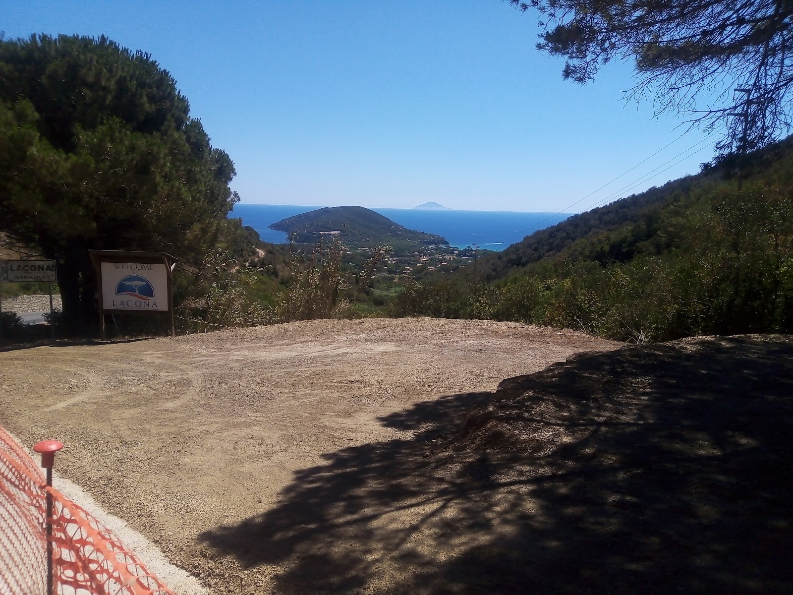
Finally today was the day of Monte Calamita, here on the Island of Elba. Starting from Lacona, it was not easy to reach it because, cartographically, finding an 'immediate' path was impossible. So I headed for sections of the GTE up to the upper part of Portoferraio. It was essential to make this 'long mileage' choice to avoid the very dangerous road, narrow and without a border over the line with cars, buses and trucks traveling at high speed with a mixture of hairpin bends ... For my safety I had to choose a quieter and long route. Not that I was sorry to go through very scenic hilly streets but given the temperature, doing the extra kilometers was not easy!
View of Portoferraio
It was a hill that I wanted to include in my tour last year towards mount Capanne (the highest on the island) but for the reasons just explained I had to do mount Calamita in a special tour.
I left Sunday 07/31/2022 at 6.00 in the morning from Camping Stella Mare in Lacona, then up the paths towards Portoferraio, all dirt with some stretches of asphalt. I crossed various inland restaurants that I did not know where I will certainly stop to eat on other occasions...
Small chapel at the entrance to Capoliveri
After having climbed the hill I was on the Portoferraio side, where I had to walk the perimeter of a quarry to head towards the hills that would soon accompany me towards Capoliveri. In the morning the temperature was mild, even if it was already clear that soon the day would present itself with a 'burning sun' during peak hours. So it was.
An 'up and down' between paths and small streets, a few scattered houses on the path, all beautiful! Breathtaking views of the sea all around typical of a small island like Elba. On one side I saw the sea of Lacona, on the other that of Portoferraio, on one side Italy ... Landscapes not every day! Many ships on the horizon in every corner.
Capoliveri Church with grotto, Madonna delle Grazie
Church in the background
The kilometers go by and here comes the urban centers, small villages with intense traffic. Then again paths in the middle of the woods. A feature that catches the eye is undoubtedly the one concerning the type of land on the island, that is, dusty, dry, which sdirty you and sticks to your skin and clothes.
Piazza Copoliveri for the fountain, on the way back
View from Capoliveri
I arrive in the outskirts of Capoliveri after eight o'clock in the morning, after all it is all thanks to the fast still low temperature. A very long climb begins that goes around the summit where the village is perched, near the coast. Choice to widen the tour always linked to traffic and avoiding the main road as much as possible. After other kilometers I arrive in the center of Capoliveri where I stop for a snack and a drink (I had been visiting two evenings before and I knew the presence of that fountain), so ten minutes later I was already towards Monte Calamita. A few kilometers on an asphalted road on the coast (I noticed a few thousand cacti on the slopes of the cliff), then a little visible path on the left and I start looking for the shadow adjacent to the few plants present. A very steep climb and other kilometers that flow under my feet. I reach the Punta del Monte calamita after 10.00 in the morning, I pass some picnics and go up again reaching the fenced military base. I sit under a turret full of cameras and other gadgets, for the second snack. I observe in the distance the island of Montecristo, that of Pianosa and Monte Capanne always visible with its over 1000m of altitude.
Military turret on Monte Calamita
View of Monte Calamita, two strips of sea. Lacona and Portoferraio
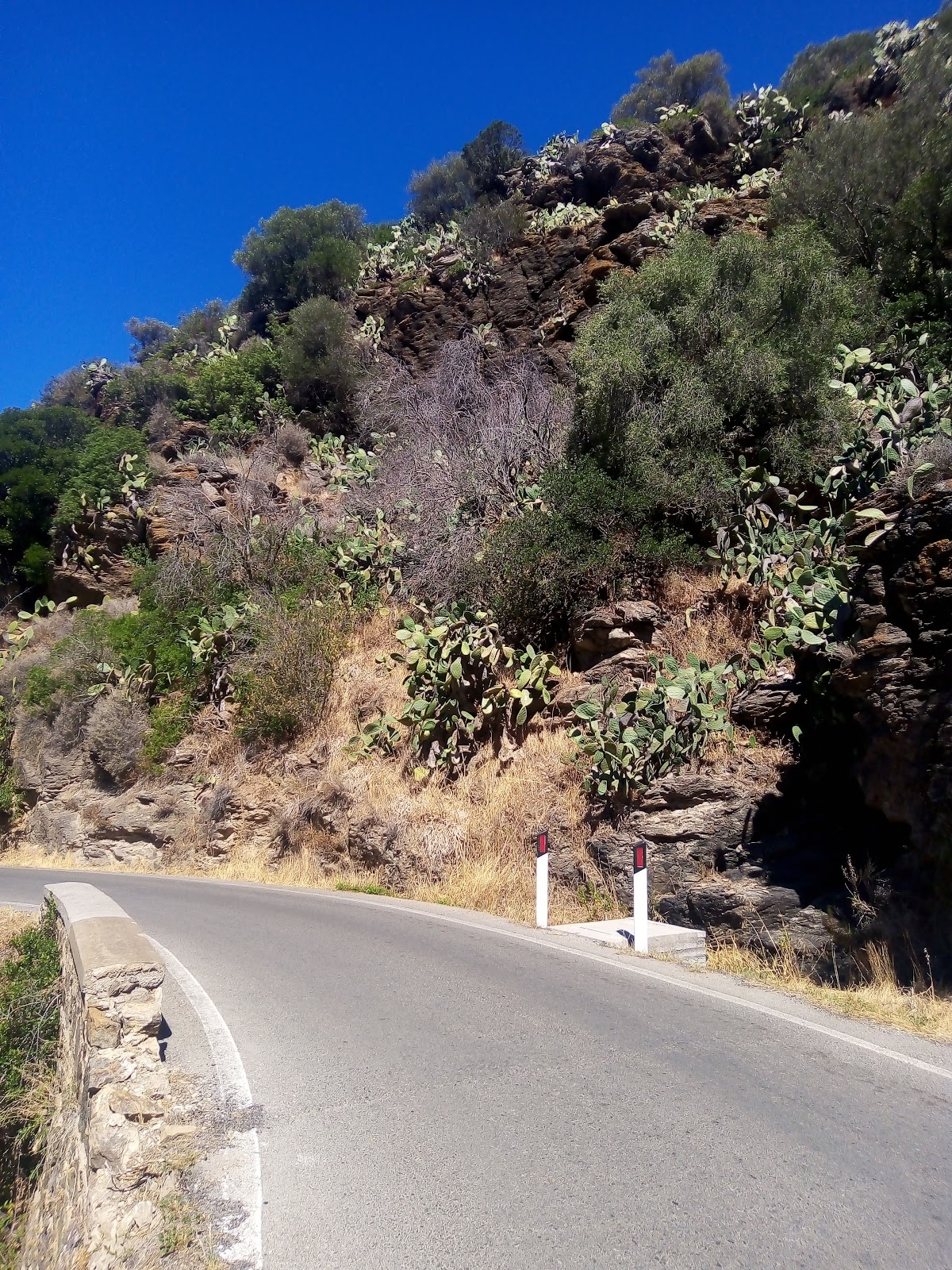
Cactus on the road
The return begins in scorching heat. I take photos and videos, I drink every 30 minutes, I can't help it. One more trip to Capoliveri to fill up the water bottles, drink and freshen up. I decide to go along the main road for a small part, a stretch on secondary stairways at the last minute in order to save a few kilometers on the outward journey.
An unexpected fountain
The heat grows from kilometer to kilometer and when I return the hardest climb towards Portoferraio begins, I think the temperature is around 40 degrees but I have no tools to measure it. I write with absolute certainty thatthat the sticks were hot in my hands! The pace becomes slow and stunted and in the few flat stretches it becomes impossible to run. The fast water runs out despite the three 0.5L bottles I had below. When I arrive at the point closest to Portoferraio I find in the middle of 'nowhere' a disused aqueduct fountain complete with a meter that still throws a trickle of precious water. I quench my thirst, I fill the bottles, I refresh myself, it is 2.00 pm and it takes 10 minutes to leave slightly regenerated. I walk to save up to the main road towards Lacona, all a climb. I go down to the side of the quarry already met at the beginning and I undertake a long descent and find a shaded area for the last snack before arrival. At 14.55 I am in Lacona near my campsite and the GPS is close to 40km, but unfortunately I have activated the instrument a couple of kilometers later and so the measurement is not exact. I walk the last kilometer to the camper. It's about 8 hours and 40 minutes according to the clock, even if for me the time is now completely relative since I take my time with videos, photos and snacks ... The heights of the island are not comparable to the Alpine ones of my Po Valley.
View of Lacona during the final descent
It was a nice walking adventure which, despite the Saharan heat, ended well. However, I could not have covered more kilometers with those temperatures. In an upcoming outing in such hot areas with little water I will try to leave at night to arrive before rush hour, in order to make walking easier! You learn by making mistakes.
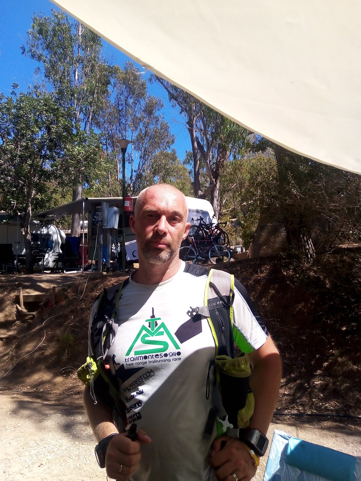
Me upon arrival at the campsite
Also this adventure, as my usual, was prepared with the technique of the weekly Monotraining for the ultratrail
LIVE VIDEO in italian laguage:
Below is the detail of
the reference links related to my ultratrail and trail articles: