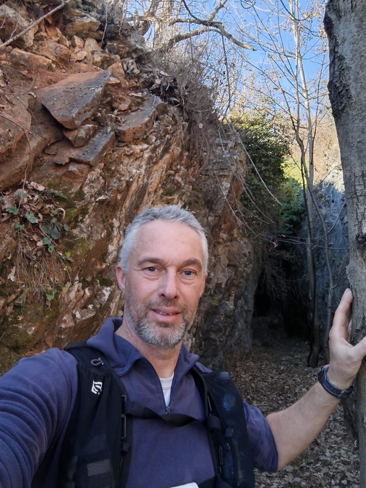
domenica 15 giugno 2025

Envie - Busca, solo walking adventure at the alabaster quarries - Weekly Single-Training Technique


 A few weeks ago, I heard about this unique place, the alabaster quarries in Busca, and over time, my curiosity grew immensely. Taking advantage of the holiday break, I finally brought the adventure to life! Once again, everything was carried out using the Weekly Single-Training Technique: http://www.bertinettobartolomeodavide.it/ultratrail/index.html.

I'm not sure why, but Busca seems to be a recurring place in my life—and now I'm here to share this incredible walking adventure.


I set off leisurely on the morning of December 30, 2024—I was on the road outside my house by 9:30, so not particularly early. However, this was exactly what I had planned, considering the nightly frosts that are common in the Envie area. The temperature was likely a few degrees below zero, but the sun was beginning to rise, promising to warm up the day soon.

I reached Saluzzo shortly before 11:00, though the stretch near the Po bridge after Revello always adds quite a few kilometers to my journey, as I have to follow the river for a long distance before reconnecting with the road. This results in a significant loss of kilometers—at that point, I might have already entered the municipality of Saluzzo, but that’s just the way things are.

In any case, I realized too late that the Po was dry, meaning I could have waded across—but by then, the decision was already made!
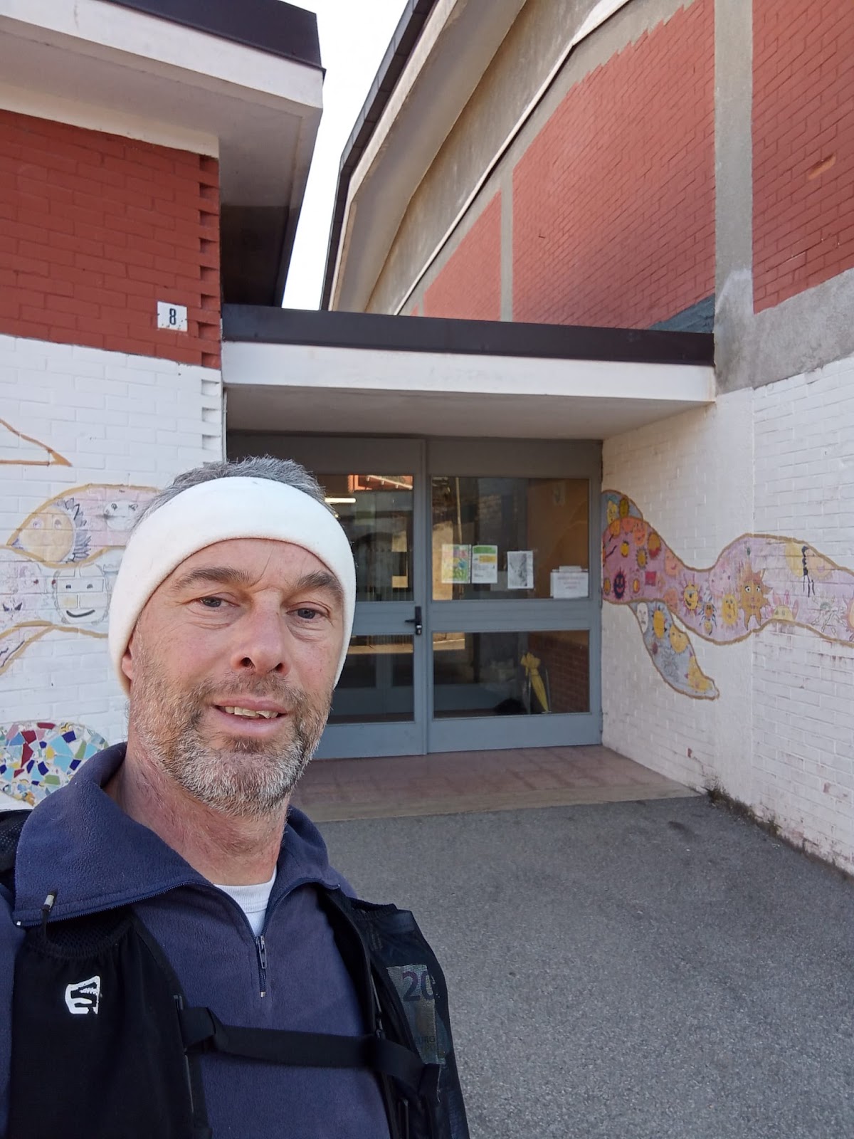


I passed through Saluzzo fairly quickly and stopped by my school for a quick selfie in front of the gym entrance, where I teach my students. It's always great to reconnect with work—especially since it's something I genuinely love.

Perhaps I've been fortunate in life, as I’ve always pursued activities that fully fulfill me. For me, it's more than just a profession—it's a true calling.


Returning to the journey, I can say that I took the bike path to pass through Saluzzo, Manta, and Verzuolo. Then, I followed the road toward Piasco. The Piasco stretch felt endless, not due to fatigue, but purely because of its long distance—I hadn’t remembered that crossing it on foot would take so much time!

Upon reaching the roundabout, I headed toward Rossana, taking the road that passes in front of the Bitron company. For several kilometers, there were houses on one side and hills to my left, as I ascended into Valle Varaita.

Keeping an eye out, I searched for a bar before tackling the climb toward Busca, and fortunately, one appeared. A quick coffee break, though I chose to sit at the table rather than stand, and then I shouldered my backpack once more, continuing along the sidewalk and later back onto the roadside, finally reaching the entrance of the anticipated climb.
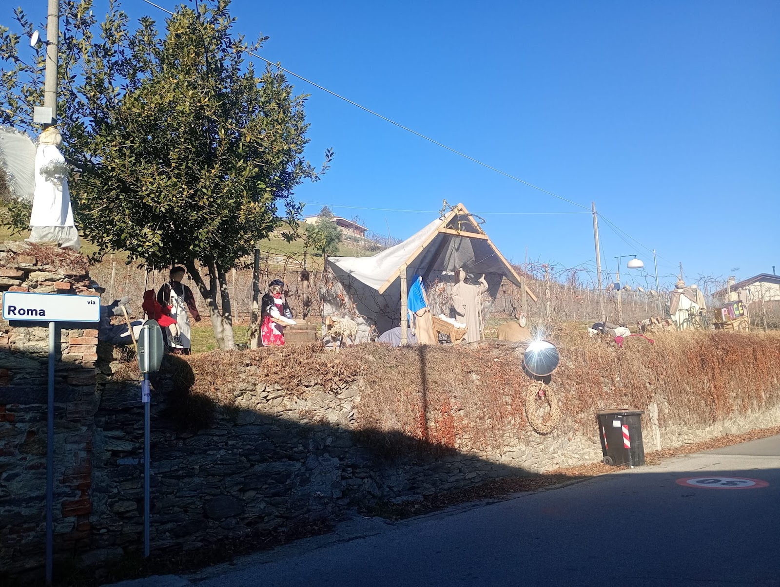


A gentle climb for a few kilometers, with many cyclists crossing my path—it was understandable, given the beautiful weather. In fact, the temperature had risen enough that I had already removed my gloves and headband back in Verzuolo—even rolling up my sleeves to the elbows!


At the top of the colletta, I got 'lost' via Eremo, completely absorbed in the scenery, to the point that I stopped paying attention to the GPS directions on my Fenix. As a result, I descended for several kilometers before realizing my mistake!

In fact, my watch kept sounding alerts, but my thoughts at the time drowned out every warning


 I turned back and climbed up toward Via Eremo, following the GPS directions onto the dirt path through the woods. I ventured along a desolate trail through the thicket for about 500 meters, and then—there it was, the first quarry!

It was stunning, but I chose not to enter, wanting instead to enjoy the warmth of the sun for a 10-minute snack break. At 14:41, I gazed into the winding cavity, stripped of alabaster, no more than 1.5 meters wide, with walls rising steeply—I only peeked inside, but I estimate it reached perhaps 30 meters deep.

I couldn’t help but think about the hazards of that area—if anything had disturbed the ground above, it could have sent rocks tumbling down. At the same time, I reflected on the element of discovery—had I not found the quarry immediately, I might have approached it from above and stumbled into that dangerous crevice in the terrain!

If anyone decides to visit, they should exercise maximum caution!


 I’m not quite sure about the current state of the area, as it appears abandoned, with vegetation slowly overtaking the site. It’s unclear whether these quarries are privately owned or municipal, since I didn’t find any signs or access restrictions from the direction I entered. However, I believe it would be wise to mark and regulate access, allowing entry only under the guidance of a professional.

There are several veins, though I only came across the first one I found—especially since it’s advisable to wear a helmet in that area, so I chose to hold back.

I think about how many artists must have been inspired by these now-barren yet fascinating quarries, once filled with precious alabaster that shaped remarkable works of art in various churches—even in faraway places. Perhaps the most famous example is the Basilica of Superga.

Today, we witness a vanished wealth, yet it leaves behind a breathtaking landscape reminiscent of the Grand Canyon. I once read somewhere that Busca alabaster was so highly valued in the past that its patterns were replicated on wooden panels, making it affordable for a wider audience.
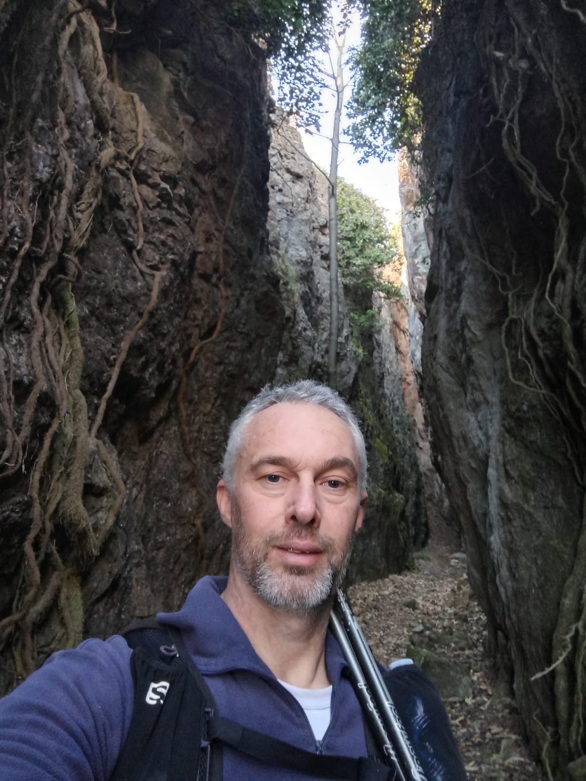
 

I met other visitors in that area while descending, so I took the opportunity to gather some information about the best route toward Busca. With that, I was ready to head down and complete the adventure, reaching the town center at 15:29.

A moderate walking route, considering it was 'only' 38 km, covered in 5 hours and 57 minutes, with a very light elevation gain, except for the Rossana colletta section.

Update (17-01-2025): I later discovered that there’s a great online description, complete with GPS track and hiking details, which I’m sharing here: http://www.museoappunti.it/il-museo/appunti-di-geologia/alabastro-di-busca.

ALMOST FORGOT—HAPPY NEW YEAR TO EVERYONE!

P.S. If you get the chance, check out my website: www.bertinettobartolomeodavide.it or visit my Facebook page: https://www.facebook.com/Bertinetto.BartolomeoDavide76.

Prof. Bertinetto Bartolomeo Davide
Osteopath D.O. - Iridologist - Sports Trainer at Any Level


VIDEO LIVE ADVENTURE:


 Below is the detail of the reference links related to my ultratrail and trail articles:

Very long distances | Routes | Competitions | Solo adventures | TRAVEL TRAIL | Publications | Training strategy |
UltraTrail eBook |


An outing achieved with the mind, 29km from Boves (San Giacomo), Bisalta, Limone P.te and back - Weekly Single-Training Technique.


I had been planning this walking adventure between Boves (San Giacomo), Bisalta, Limone P.te, and back for several months. However, due to my studies, I wasn’t able to fit it into my July schedule, so it had to be postponed.

In July 2024, I intended to complete it using a hybrid bicycle/ultratrail technique, but things turned out differently because of the final commitments related to my osteopathy training. Now, though, the hardest part is done—next weekend, I will finally complete these six years by defending my thesis!

But let's focus on today, Sunday, December 1, 2024, and talk about this beautiful route, undertaken after about five months of training hiatus


Everything was accomplished solely through mental strength, rather than recent training sessions. In fact, this walking achievement is the result of a training approach focused on both ultra and non-ultra distances over a couple of decades, with preparation ensured by the Weekly Single-Training Technique for ultratrail.

It is fascinating, through this walking journey, to discover how deeply ingrained one's preparation can be thanks to the Weekly Single-Training Technique—especially when practiced for nearly two decades in the world of Ultra-Distances. Let's delve into the details...


I deliberately started late: I arrived at the location (San Giacomo di Boves) at 10:18 in the morning, considering the freezing temperature of the area and the towering peaks nearby, which cast a shadow that struggled to fade.

Step by step, I gained altitude towards Bisalta, and the first rays of sunlight began to warm me. At the first opportunity, I removed both my gloves and the headband.


I reached the watershed, just above Rifugio Peveragno (or at least I believe that's its name, as I've always found it closed). Once there, I treated myself to my first snack, sitting on the grass of a sunlit meadow. The view from that spot was breathtaking!


 Then began a long descent through trails covered in leaves, with stones underneath in some sections, making slipping quite easy. At times, I lost my way—not due to my new GPS watch, the Fenix 7, but because I had mapped out the GPX route rather roughly on my computer.

Despite that, I was guided towards my destination with remarkable accuracy. In fact, I used WikiLoc as additional support only when I had doubts about the actual trail.


I didn't encounter many people—just three hikers along the entire route, despite a few cars being parked at the starting point.

At higher altitudes, the temperature was perfect, and at times, I even felt sweaty. On several occasions, I improvised various snacks. I moved at a steady and relaxed pace, also to avoid exhausting myself, as my physical condition, as mentioned earlier, is quite fragile at the moment.

However, I didn't experience any moments of weakness and even managed to complete the return journey faster than the ascent!


Some climbs, especially on the way back, felt endless. However, the long descents that followed were just as exhausting. I believe this is due to my overall lack of preparation at the moment, given my upcoming thesis defense.

I hope to get back on track soon and resume training regularly with the Weekly Single-Training Technique, just as I did a few years ago. I wouldn’t classify this trail run as hiking, since I ran on the descents and flat sections, walking only on the climbs.

I was slow, but this was also an experiment to assess my performance after a long break—a confirmation of what I have always maintained about the Weekly Single-Training Technique, as it trains you for infrequent activity (sometimes very infrequent!).


After passing through the many hamlets hidden within dense forests, I must say the trail above Vernante towards Limone truly feels like stepping back in time. These isolated and distinctive places evoke visions of a bygone era, where life was built on pure self-sufficiency. As I mention in my LIVE YouTube video (which runs parallel to this text), living this way would still be possible today—provided one embraces a simple lifestyle. You can view the entire route with the GPS track available on WikiLoc.

At a certain point, I realized it was getting late, and with some reluctance, I had to leave that beautiful trail behind, shifting onto the main road to reach my destination quickly. That said, I haven’t abandoned the idea of the hybrid Bike/Trail activity I mentioned earlier—I plan to repeat it fully next time, possibly in summer 2025.

I then ran a few kilometers along a steady, gentle ascent leading into the town of Limone, following the highway. Upon reaching the central square, I took a moment to look around, reminiscing about past years when I was ready to compete in various editions of the famous Cromagnon race.

I also recall a particular year—it might have been 2015—when I didn’t take part in the race but was there as a representative for Fusta Editore, temporarily promoting my book to the athletes present.

At some point, I made my way towards the bar for a coffee, a habit that has now become a ritual in every route I take.


There was beautiful sunshine in Limone, though it felt a bit strange to see that charming mountain town completely devoid of snow on the first day of December.


A few minutes later, I began the return journey (by then, I had covered just over 14.5 km), following exactly the same route: the main road, then the trail through the abandoned hamlets scattered along the path from Limone to Vernante, and finally the endless climb back up towards Bisalta.

Around 16:30, I was once again at the watershed, above Rifugio Peveragno. By that time, the ground was completely frozen, with darkness approaching.


I took advantage of the final stretch before the watershed to have one last snack, as hunger was becoming overwhelming.

A long descent on the final section of the trail—covered in leaves with hidden stones underneath (just like the climb)—required great caution to avoid slipping.

By 17:00, it was completely dark, so I switched on my LED headlamp, along with the Garmin’s built-in LED light, to ensure maximum visibility and prevent any falls or sprains (which, fortunately, didn’t happen). I must say, the light on the watch is incredibly bright and incredibly useful!


I arrived at my car around 17:30, seeing my breath turn to vapor in the freezing air—I'm certain the temperature was below zero, especially since the entire ground sparkled with ice crystals.

I must add that my new Garmin watch performed very well, just as my previous model from the same brand did. However, it was a huge relief not to worry about the battery running out—thanks to the solar panel integrated into the display!


This walking adventure was highly rewarding, both as an opportunity to explore my actual capabilities during a period of no training and as a chance to restart my outings, with the goal of undertaking more in the near future."

This keeps the essence of your reflections while ensuring clarity in English. Let me know if you'd like any refinements!


In the end, it was more than 29.5 km, with a total elevation gain of 3,600 m, completed in 7 hours and 26 minutes. I'm satisfied, as this marks a fresh starting point for resuming training with ease—laying the foundation for future Trail and Ultra-Trail adventures ahead.

A small unfortunate twist to wrap things up: as I was leaving the parking area, I realized I had a flat tire. That moment brought on immense exhaustion, given the demanding journey I had just completed.

However, to get home, I had to mount the spare tire, which—naturally—was completely deflated, as it had never been used. Thankfully, a kind herdsman was ready with a compressor to help. So, I found myself forced to work in the freezing cold and pitch darkness of the mountains—something that had never happened to me after a walking journey before.


 VIDEO LIVE BY YOUTUBE:


PERCORSO GPS BY WIKILOC:

https://it.wikiloc.com/percorsi-escursionismo/san-giacomo-di-boves-bisalta-limone-e-ritorno-193609155


Below is the detail of the reference links related to my ultratrail and trail articles:

Very long distances | Routes | Competitions | Solo adventures | TRAVEL TRAIL | Publications | Training strategy |
UltraTrail eBook |


Hiking excursion from Rifugio Melezé (Bellino) to Bivacco Carmagnola (Maira Valley border) - Weekly single-training technique.


Today(14-06-2025), I finally embarked on a hiking adventure that I had been planning for several weeks but was forced to postpone until the snow melted, given that the highest altitude reached was nearly 2,850 meters!

The original idea was to complete the entire route from Rifugio Melezé to Acceglio (Viviere), but there remained the issue of retrieving the car, which would have meant a tedious return along the same path for many kilometers.

During the night (with little to no sleep!), I came up with the idea of splitting the journey and heading to the highest planned altitude to reach the beautiful Bivacco Carmagnola. After reaching this intermediate stop, I returned to my car. I will tackle the other part of the route from Acceglio to Bivacco Carmagnola on the next suitable occasion.


As I already mentioned during the adventure between Pian Muné and Sant’Anna, these routes will be part of a broader plan that I am gradually building… But I won’t reveal anything yet, as I’m waiting for all the trails to be completed to create one great itinerary!

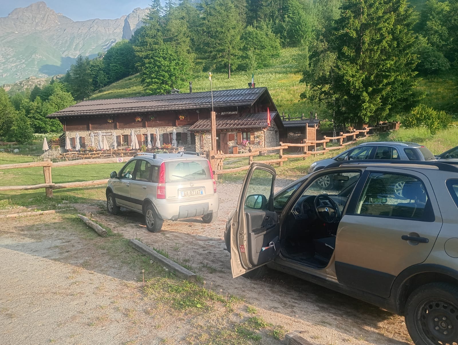
I set off from Rifugio Melezé at 7:16 and followed the gentle incline to Sant’Anna di Bellino on asphalt. From there, the road turned into a passable dirt mule track. Though almost immediately, I took the wrong direction—perhaps due to the narrow valley, my Garmin acted up. After about fifteen minutes heading the wrong way (toward Rocca Senghi), a passerby pointed me toward the correct route...


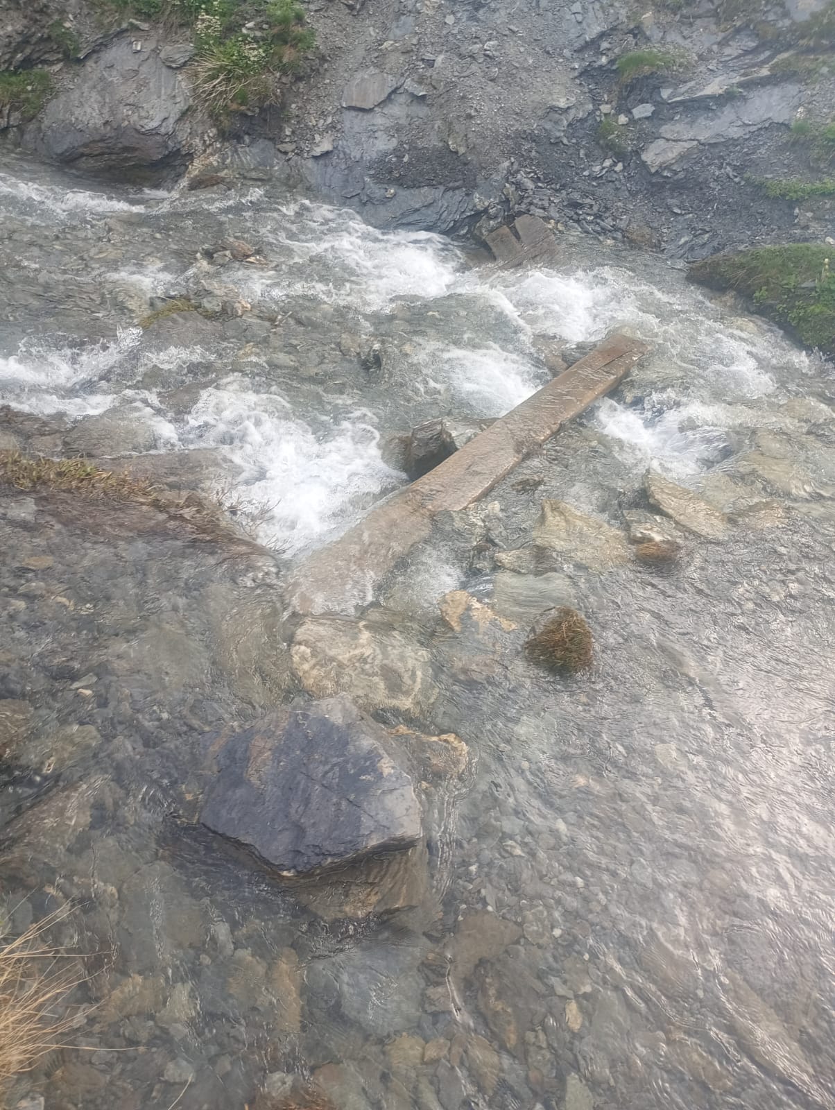
I continued through flat pastures with a steady ascent. At a certain point, however, after passing Pian Ceiol and heading toward Le Barricate, the incline became truly demanding! The path runs alongside a rushing stream, a tributary of the Varaita di Bellino. Here, the trail follows the stone-lined edge, right beside some small waterfalls. Crossing the water requires great caution, as there are a few beams just 20 cm wide—one must step carefully, one foot in front of the other... or risk an unfortunate plunge into the water!

Moving forward, a new plateau opens up, with high-altitude pastures and a few old mountain huts—perhaps abandoned, but not in terrible condition. I wonder what it must be like to live up there, so far from everything! Grange dell’Autaret area.


There was no snow, but as I ascended toward 2,800 meters, I encountered many rocky patches mixed with scree. Some required caution, as small streams flowed beneath them, their murmuring sound constantly audible.

The scree consisted of thin fragments that slipped away underfoot, further complicated by the high presence of water on the ground, which made everything slick.

As I approached the watershed ridge, I started to glimpse a few structures. The most intriguing one, which I didn’t visit, was a large reinforced concrete bunker—a remnant of the war. Then, a clearly visible meteorological antenna and several scattered stone structures nearby.


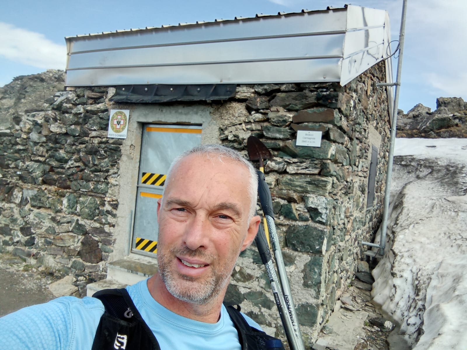
From the Bellino side, there were no visible signs indicating the presence of the bivouac… which was quite alarming! However, once I reached the ridge and followed the markings toward the summit (La Colletta near Monte Faraut, trail S2), just a little further ahead, the bivouac appeared in all its glory!

At first glance, it seemed small, but once inside, the perception changed—it was entirely made of wood, with several bunk beds, a radio area, solar-powered electricity, some food supplies, various tools, and more. A place open to all, yet one that demands great respect from those passing through, as keeping it intact is essential!


After completing the exploration at an altitude of 2,840 meters, around 10:10 AM, I began the descent back. On the rocky terrain, I improvised, taking a more direct route compared to the ascent, especially since the path was only partially visible due to patches of snow.

It’s incredible how the return journey, partly because of the downhill slope and partly due to the eagerness to get back, is always noticeably faster than the ascent!

As the morning progressed, I started crossing paths with hikers making their way up while I was descending. The heat was becoming noticeable, though during the climb, I had occasionally encountered a light drizzle that had provided some refreshing relief.

I reached Rifugio Melezé just before noon, covering a total distance of 17.66 km in 4 hours and 28 minutes. A customary post-hike coffee at the refuge, a quick chat with the host, and then back home by car.


As is my custom, this adventure was prepared using the Weekly Single-Training Technique. Although it didn’t fully align with a trail-running style—except for the downhill running—I still completed the route in a hiking mode, following the principle of a single weekly training session, as this method teaches, to protect the joints and support recovery.


Video Live Youtube of adventure:


Below is the detail of the reference links related to my ultratrail and trail articles:

Very long distances | Routes | Competitions | Solo adventures | TRAVEL TRAIL | Publications | Training strategy |
UltraTrail eBook |


sabato 14 giugno 2025

Escursione a piedi dal Rifugio Melezé(Bellino) al Bivacco Carmagnola(Confine Valle Maira) - Tecnica Monoallenamento Settimanale


Oggi(14-06-2025) ho finalmente iniziato un'avventura a piedi che pianificavo da alcune settimane, ma che sono stato costretto a rimandare in attesa che svanisse la neve, visto che la quota massima raggiunta è stata quasi di 2850m!

L'idea originale era di percorrere interamente il tragitto dal Rifugio Melezé fino ad Acceglio (Viviere), ma restava il problema del recupero dell'automobile, cosa che avrebbe comportato un noioso ritorno lungo lo stesso percorso per molti chilometri.
Durante la notte(sonno mancato!), ho avuto l'idea di spezzare il tragitto e recarmi alla massima quota prevista per raggiungere il bellissimo Bivacco Carmagnola. Dopo aver raggiunto questa tappa intermedia, ho fatto ritorno all'auto. L'altra parte del percorso la affronterò da Acceglio verso il Bivacco Carmagnola nella prossima occasione utile.


Come ho accennato già nell'avventura tra Pian Muné e Sant'Anna, questi percorsi faranno parte di un 'disegno' più ampio che mi sto accingendo a costruire... Ma non anticipo nulla, perché attendo la conclusione di tutti i tracciati per arrivare ad un unico grande itinerario!

Sono partito dal Rifugio Melezé alle 7:16 e ho percorso il falso piano fino a Sant'Anna di Bellino, su asfalto. Da qui, la strada è diventata una mulattiera sterrata carreggiabile. Anche se quasi subito ho imboccato la direzione sbagliata: forse a causa del vallone stretto, il Garmin ha fatto qualche capriccio. Dopo una quindicina di minuti nella direzione errata (verso Rocca Senghi), un passante mi ha indicato la strada corretta...


Ho proseguito tra pascoli pianeggianti con una salita costante. Ad un certo punto, però, superato Pian Ceiol e andando verso Le Barricate, la pendenza è diventata davvero impegnativa! Si costeggia un fiumiciattolo che scorre impetuoso ed è affluente del Varaita di Bellino. Qui il sentiero segue il bordo, interamente in pietra, a ridosso di alcune piccole cascate. Per attraversare la corrente d'acqua è necessaria molta attenzione, perché sono presenti alcune travi larghe 20 cm da percorrere un piede davanti all'altro… pena una rovinosa caduta a mollo!

Proseguendo, si apre un nuovo pianoro con pascoli d'alta quota e qualche vecchia baita, forse ormai abbandonata ma non in condizioni così pessime. Mi chiedo come deve essere vivere lassù, lontanissimi da tutto! Zona Grange dell'Autaret.


La neve era assente, ma salendo verso i 2800 m si trovavano molti banchi misti a pietraia. Alcuni richiedevano attenzione, perché al di sotto scorrevano piccoli corsi d'acqua, il cui rumore era sempre percepibile.

La pietraia era costituita da brandelli sottili, che scivolavano via sotto i piedi, anche a causa dell'alta presenza d'acqua sul terreno che rendeva tutto viscido.

Man mano che mi avvicinavo alla cresta dello spartiacque, iniziavo a intravedere delle strutture. La più curiosa, che non ho visitato, è un grosso bunker in cemento armato, residuo della guerra. Poi un'antenna ben visibile, di tipo meteorologico, ed alcune strutture in pietra sparse lì attorno.


Del bivacco osservando dal versante di Bellino, nessuna traccia di segnalazioni... cosa che mi ha allarmato non poco! Tuttavia, arrivato in cresta e seguendo le indicazioni verso la vetta(La Colletta nei pressi del monte Faraut) (sentiero S2), poco più avanti il bivacco è emerso in tutto il suo splendore!

All'apparenza piccolo, ma una volta dentro le dimensioni sembrano cambiare: interamente in legno, con vari letti a castello, zona radio, energia elettrica da pannello solare, un po' di cibo, attrezzi vari ed altro. Un luogo a disposizione di tutti, che però richiede grande rispetto da parte di chi vi transita, perché è fondamentale lasciarlo intatto!


Terminata la perlustrazione all'altezza di 2840 m, alle ore 10:10 circa, è iniziata la discesa per il ritorno. Sulla pietraia ho improvvisato, imboccando una via più diretta rispetto a quella della salita, anche perché il sentiero era visibile solo a tratti per via dei banchi di neve.

È incredibile come il ritorno, un po' per la discesa e un po' per la voglia di rientrare, sia sempre decisamente più veloce della salita!

Vista l'ora avanzata della mattina, ho iniziato a incrociare passanti che salivano mentre io scendevo. Il caldo iniziava a farsi sentire, anche perché in salita avevo incontrato alcune volte una tenue pioggerellina, che senza dubbio rinfrescava.

Ho raggiunto il Rifugio Melezé poco prima delle ore 12:00, con una percorrenza complessiva di 17,66 km e un tempo totale di 4 ore e 28 minuti. Classico caffè di rito al rifugio, due chiacchiere con il gestore e poi verso casa, in auto.


Come mia consuetudine, questa avventura è stata preparata con la Tecnicadel Monoallenamento Settimanale. Anche se lo stile trail centrava poco, salvo la corsa in discesa, ho comunque completato la percorrenza in modalità escursionistica, utilizzando una singola uscita settimanale di allenamento, come questo metodo insegna, per salvaguardare articolazioni e recupero.


Video Live della Percorrenza: 


File Komot della traccia GPS: https://www.komoot.com/it-it/tour/2324097077


Segue il dettaglio dei link di riferimento riguardo ai miei articoli ultratrail e trail:

Lunghissime distanze | Percorsi | Gare | Imprese | TRAVEL TRAIL | Pubblicazioni | link utili | Strategia d'allenamento |

Libro UltraTrail


Cerca nel blog