SEGUE DESCRIZIONE E TEST:
Ingresso nel paese di Limone |
Erano diversi mesi che programmavo questa avventura a piedi tra Boves (San Giacomo), Bisalta, Limone P.te e ritorno. Tuttavia, per motivi di studio, non ero riuscito a inserirla nel programma di luglio e quindi era saltata.
A luglio 2024 volevo realizzarla con la tecnica ibrida bicicletta/ultratrail, ma le cose sono andate diversamente a causa delle incombenze finali legate al mio percorso di formazione come osteopata. Ora però il più è fatto: il prossimo weekend completerò questi sei anni discutendo finalmente la tesi di laurea!
Ma veniamo alla giornata di oggi, domenica 1 dicembre 2024, e parliamo di questa bella percorrenza, realizzata dopo circa cinque mesi di latenza dall'allenamento.
Mappa |
Tutto è stato "messo insieme" unicamente con la "forza della mente" e non grazie ad allenamenti recenti. Infatti, questa realizzazione a piedi è frutto di una formazione rivolta alle percorrenze ultra e "non ultra" di un paio di decenni, con la preparazione garantita dalla tecnica del Monoallenamento Settimanale per l'ultratrail.
È interessante, con questo giro a piedi, scoprire quanto siaindelebile la preparazione che una persona può avere grazie alla tecnica del Monoallenamento Settimanale, se praticata per quasi due decadi nel mondo delle Ultra-Percorrenze. Vediamo nel dettaglio...
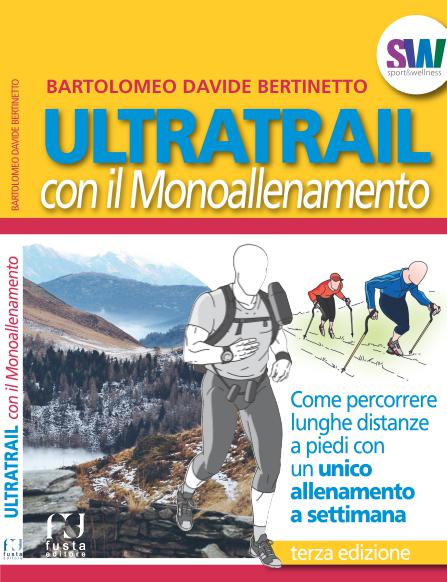
Copertina libro - UltraTrail con il Monoallenamento |
Sono volutamente partito tardi: ero sul posto (San Giacomo di Boves) alle 10:18 del mattino, vista la bassissima temperatura di quella zona con le adiacenti alte vette che proiettano un'ombra che faticava a smorzarsi.
Passo dopo passo, sono salito di quota verso la Bisalta, e i primi raggi di sole hanno iniziato a scaldarmi. Alla prima opportunità ho tolto sia i guanti che la fascia al capo.
Cartello sullo spartiacque |
Sono arrivato sullo spartiacque, poco sopra il Rifugio Peveragno (o almeno credo sia quello il suo nome, dato che l'ho sempre trovato chiuso). Giunto lì, mi sono concesso il primo spuntino mentre ero seduto sull'erba di un prato, ben esposto al sole. Panorama stupendo da quel punto!
Foto panoramica sullo spartiacque |
Poi è iniziata una lunghissima discesa tra i sentieri pieni di foglie, con sotto pietre a tratti che rendevano molto facile lo scivolone. A volte ho perso la strada, ma non a causa del mio nuovo orologio GPS Fenix 7, bensì perché avevo tracciato in modo molto grossolano la via GPX al computer. Nonostante ciò, sono stato accompagnato verso la destinazione con molta precisione. Infatti, usavo a supporto il solito WikiLoc solo in caso di dubbi sull'effettivo sentiero.
Piccola ghiacciaia a ridosso di un ruscello - tra due borgate |
Non ho incontrato molta gente, solo tre camminatori su tutto il tragitto, nonostante ci fossero alcune macchine al parcheggio.
In alta quota la temperatura era ottima e a volte mi sono sentito sudato. In alcune occasioni ho improvvisato spuntini vari. Ho proceduto con tutta calma anche per evitare di "scoppiare", dato che la mia forma fisica, come già anticipato, è davvero precaria in questo periodo. Tuttavia, non ho avuto episodi di cedimento ed ho condotto il ritorno perfino più speditamente dell'andata!
Una delle tante borgate abbandonate |
Alcune salite, specialmente al ritorno, le ho trovate interminabili. Tuttavia, le lunghe discese successive facevano lo stesso effetto stremante. Ritengo che ciò sia dovuto alla mia mancanza di preparazione generale in questo periodo, vista la discussione della tesi imminente. Presto confido di rimediare e rimettermi in carreggiata con la tecnica del Monoallenamento Settimanale, in modo regolare, proprio come facevo qualche anno fa. Diciamo che questo giro trail non lo classificherei come escursionismo, dato che ho corso in discesa e pianura, camminando solo in salita. Comunque ero lento, ma è stato anche un esperimento per verificare la prestazione dopo una lunga pausa, a conferma di ciò che ho sempre sostenuto riguardo la tecnica del Monoallenamento Settimanale, dato che ti addestra all'attività infrequente (a volte molto infrequente!).
Fontana buonissima in un luogo desolato |
Oltrepassate le molte borgate avvolte dal fitto bosco, devo dire che il sentiero sopra Vernante verso Limone fa respierare davvero un'atmosfera di 'altri tempi'. Luoghi caratteristici e isolati che evocano fantasie di vita passata, fatta di pura autosufficienza. Infatti, come affermo nel video LIVE di YouTube (in parallelo a questo testo), sarebbe certamente possibile vivere così anche oggi, a patto di accontentarsi di uno stile di vita semplice. Potete visionare l'intero tragitto con la traccia GPS presente su WikiLoc.
Ad un certo punto ho notato che si stava facendo tardi e, a malincuore, ho dovuto abbandonare quel bellissimo sentiero per approcciarmi allo stradone e raggiungere in modo celere la destinazione. Tuttavia, non ho abbandonato l'idea dell'attività ibrida Bici/Trail, già menzionata sopra, per ripeterla prossimamente in modo completo. Magari sarà per l'estate 2025.
Ho quindi corso per alcuni chilometri a ridosso di una costante leggera salita fino al paese di Limone, seguendo la statale. Raggiunta la piazza centrale, mi sono guardato un po' attorno, immaginando gli anni passati, quando ero pronto per partecipare a varie edizioni della famosa competizione Cromagnon.
Ricordo anche un anno (potrebbe essere stato il 2015) in cui non avevo partecipato a quella gara, ma ero lì come standista per Fusta Editore, mansione provvisoria necessaria per promuovere il mio libro agli atleti presenti...
Ad un certo punto mi sono orientato verso il bar per il caffè, ormai diventato un'abitudine in ogni percorrenza che svolgo.
Caffe presso il Bar sulla piazza centrale di Limone P.te |
A Limone c'era un bel sole, anche se era un po' strano vedere quel bel paese montano completamente privo di neve il primo giorno di dicembre.
Rifugio Peveragno(forse) |
Pochi minuti dopo ho intrapreso la via del ritorno (fino lì erano stati poco più di 14,5 km), seguendo esattamente lo stesso percorso: stradone, poi sentiero tra le borgate abbandonate sparse sulla via da Limone a Vernante, e quindi su verso la Bisalta con una interminabile salita. Intorno alle 16:30 ero nuovamente sullo spartiacque, sopra il rifugio Peveragno. A quell'ora la terra era già completamente ghiacciata, con il buio alle porte.
Bisalta al tramonto |
Ho approfittato nel tratto finale prima dello spartiacque per gli ultimi spuntini, dato che la fame si faceva sentire prepotentemente.
Una lunga discesa sul sentiero finale, coperto dalle foglie con tratti di pietre sottostanti (come per la salita), richiedeva molta attenzione per non scivolare.
Ormai alle 17:00 era pienamente buio, quindi ho acceso la torcia a led sulla fronte, insieme all'illuminazione led del Garmin, per prestare la massima attenzione a possibili cadute o distorsioni (che fortunatamente non si sono verificate). Devo dire che la luce sull'orologio è luminosissima e utilissima!
Funghi decisamente fuori scala! |
Sono arrivato all'auto alle 17:30 circa, vedevo il vapore fuoriuscire mentre respiravo, quindi sono sicuro che la temperatura fosse sotto zero, anche perché tutto il terreno brillava con i suoi cristalli di ghiaccio...
Aggiungo che il mio nuovo orologio Garmin si è comportato molto bene, come del resto faceva già il vecchio modello della stessa marca. Era un sollievo enorme però non avere il pensiero della batteria che poteva scaricarsi! Anche in virtù del pannello solare integrato al display.
I miei due Garmin, prima e dopo! |
Questa avventura a piedi è stata prolifica, sia perché ho potuto indagare le mie reali possibilità in un momento di completa assenza di allenamento, sia come occasione per ripartire con le uscite, con l'intento di realizzarne altre nel prossimo futuro.
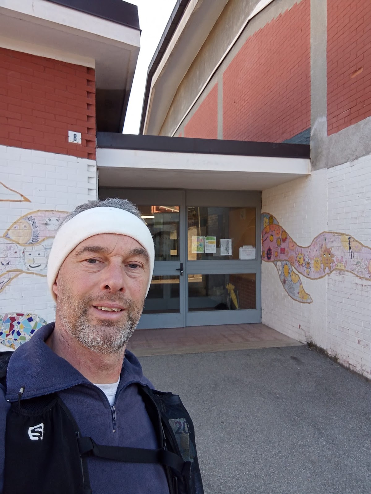
Io alla fine, nella notte. Di nuovo a San Giacomo |
In definitiva sono stati più di 29,5km con un dislivello complessivo di
3600m con un tempo totale di 7 ore e 26 minuti. Sono soddisfatto, dato
che questo rappresenta un nuovo punto di partenza per ripartire
serenamente iniziano da qui gli allenamenti per le prossima avventure
Trail e Ultra-Trail...
Piccola nota negativa finale. Purtroppo, alla fine, mentre uscivo dal parcheggio, mi sono reso conto di aver bucato una gomma dell'auto. Questo evento ha generato una grande stanchezza vista la percorrenza appena completata. Tuttavia, per tornare a casa, il ruotino era da montare (ovviamente sgonfio perché mai usato, ma un margaro gentile è stato pronto con il compressore). Così mi sono messo obbligatoriamente al lavoro, al freddo e al buio di quelle montagne. Non mi era mai successo dopo una percorrenza a piedi.
Retromarcia frettolosa al buio, un masso urtato che mi scoppia la gomma! |
VIDEO LIVE DA YOUTUBE:
PERCORSO GPS DI WIKILOC:
Segue il dettaglio dei link di riferimento riguardo ai miei articoli ultratrail e trail:
Lunghissime distanze | Percorsi | Gare | Imprese | TRAVEL TRAIL | Pubblicazioni | link utili | Strategia d'allenamento |
Libro UltraTrail | Forum | Affiliazione
Dettagli su lunghe percorrenze a piedi, link:
http://www.bertinettobartolomeodavide.it/ultratrail/index.html
Monte Capanne |
360° Panorama from Monte Capanne |
The evolution is now inevitable. Among the thousand places I have been able to reach always starting from home on foot, I believe I have reached a limit because there is not much left that is interesting to explore from my residence. Therefore, with this adventure, I am starting a new way of doing long-distance walks, transforming this passion into TRAVEL TRAILER, because the places in the world to visit on foot over great distances are many, infinite!
Tour of Elba Island from Lacona to Monte Capanne |
Let's talk about the journey around Elba Island. The tour took place on July 24, 2021, starting at 5:45 AM from Stella Mare camping in Lacona (Capoliveri beach). The journey began by following the route created the night before on the computer and loaded onto the wrist GPS. For me, the wrist GPS is an indispensable tool that allows me to embark on hikes never seen or attempted before in a fairly immediate and easy way. Using an old map on-site every time there's a doubt about the path would interrupt the journey too often and make it difficult to stay within acceptable timing.
The tour of Elba Island in the direction of Monte Capanne immediately proved to be tortuous and full of steep climbs on uneven trails, rich in boulders and deep ruts left by motorcycles and rainwater.
Initially, after a brief illusion of 'speed,' I faced the first steep climb, which is not so bad when you're still fresh and full of energy—you easily overcome all difficulties. The real challenge, however, comes later. After passing the small plain of the Lacona area, I began the steep climb towards Monte Barbatoia (359m), passing through Serra del Pero. Upon reaching the ridge, you can glimpse the two sea sides of the island through the trees. I proceed, skirting the summit of Monte San Martino (370m) with a progressive upward direction. I am on the GTE (Grande Traversata Elba). I reach the mountain site 'Costa del Gualdarone,' and the photos fly. From here, I start descending at a fairly smooth pace, one of the few stretches where I can run on the trail. I arrive at the settlement and find myself in Literno, skirting a flat path along 'Via per Portoferraio,' with an unexpected obstacle: a large gate in the middle of a road marked on the map! I climb over it.
La Pila Airport seen from the hills |
Monte Capanne in the distance |
Typical stretch of steep, uneven trail |
A new climb begins, passing through Vigne Giunche, following the dirt road "Via dei Forcioni" up to Poggio San Prospero (402m). From here, a dense forest starts with a steep climb that will take me to Monte Perone (603m), a stunning place but marred by large phone repeaters (a common reality on many peaks of the island). Then I pass through a picnic area with many tables and a small closed wooden shelter. I gain more altitude and reach Monte Maolo (750m) and shortly after, I forget to check the GPS at a junction and take the wrong path, climbing for a good kilometer towards Monte Le Calanche (which I will cross on the way back) and retrace my steps to get back on track. I am at the limit of the island's vegetation, and long stretches of rugged scree along the edge of the cliff begin. I climb further, and here the via ferrata paths arrive at the foot of Monte Capanne (1019m), which I reach the summit with some climbing. There are many people up there, and soon I discover the reason: there is a chairlift. Upon arrival, I sit on the highest rock and start with some video and panoramic photos. It is beautiful to see the entire sea and clearly the outline of the whole island. Italy on one side, Capraia Island, and other islets of the Tuscan Archipelago. The breathtaking panorama makes it feel like being on top of the world on this small Elba Island! I go in search of the bar, but it is closed, a bit disheartening because I have less than half a liter of water left in my bottle. So, I switch from one sip every 30 minutes to one sip every hour. It is not easy to endure and go on despite everything; the heat is intense (I estimate 35 degrees) and the sun is scorching.
After Monte Capanne, I begin the return journey, different from the outbound route, and more rugged. I retrace the via ferrata paths and start a dense series of consecutive peaks. So, along the ridge, I cross many boulders, proceeding slowly but with great attention to the dangers, reaching Monte Calanche already mentioned (905m) and still along the ridge arriving at the summit of Monte Tiratoio (810m). From these hills, I see valleys on one side leading to the sea and a deep cliff on the other side. I cross a steep scree and reach Masso della Quata (746m), a very dry place where I notice ancient stone constructions, reinforced in more recent times, I believe with reinforced concrete. Here I also find some basins that may have been made by humans to collect the scarce rainwater. I go on for several kilometers, and the temperature becomes unbearable. Only dry and prickly bushes, but here in some stretches, I manage to run even though I am very dehydrated.
180° Photo during the ascent |
Various directions |
I hold on a bit longer and arrive at the first village descending from Monte Capanne and find the much-desired fountain in San Piero di Campo (250m), where I literally throw myself under it, drinking who knows how much, filling my bottles, and eating something. I slowly pass through the village because, after all that water at once, I know it's better to wait before running again to avoid stomach problems... This often happens to inexperienced athletes. After about twenty minutes, I briefly return to the asphalt and start jogging again, then back on the dirt road, where I find a beautiful little church that I photograph without stopping too long. I cross the dry riverbed Fosso del Bovalico and enter a new municipality (Marina di Campo); by now, I am on the coast at sea level.
Little church between San Piero and Marina di Campo
It's strange how, in a maritime situation, you gain and lose elevation, often reaching zero level (at sea), an unusual situation for someone like me, accustomed to the high alpine altitudes of the Po Valley. I had been dreaming of a nice coffee and a bottle of sparkling water for a while. So, I continue along the coast, scanning the places in search of a bar. I find a busy kiosk and, with my mask on, I stop, taking the opportunity to share my adventure with the barista and asking for some information about the remaining route. I enjoy everything while sitting at a quiet table and then resume a good pace, jogging through the small flat areas present, and soon the steep climbs resume, just to keep the habit.
Panoramic view towards the sea |
I am nearing the end of the adventure now, but the hills are certainly not lacking! I pass Colle la Foce, and the trail in this stretch is truly uneven, with huge boulders that seem like disorganized steps. Another long stretch and I reach a new repeater on Monte Tambone (377m), where I take a forced break to eat and, most importantly, to recharge my precious GPS with a backup battery. I take the opportunity to make a phone call as well. About 20 minutes pass, and the watch battery is alive again. I pack everything back into the backpack and resume the journey shrouded in fog. A steep descent begins, and I start to see my beach (Lacona) in the distance, and at the far end, Capoliveri beach. I don't stop anymore; I take the wrong path once again for about 600m, but it's not a big deal, and I quickly get back on the right track.
Visual to sea |
The coast in the distance |
I thus reach the main road, position myself on Lacona's bike path, and cross it all. Climbing towards the campsite, I record the last video. In 12 hours and 20 minutes, I complete this adventure, not very long but very concentrated in elevation changes, in fact, it is 41km with a total of 5106m of elevation gain! Ritual photo in front of the camper, and then a well-deserved rest. I must say that the old foundations created with the Mono-training strategy for ultratrail have effectively shown themselves... Very satisfied, also because, in a life of long-distance walking, my knees are still healthy, which is rare even due to age limits!
Arrival |
On a future occasion, it will definitely be necessary to do the tour on the other side of the island with Portoferraio, Monte Calamita, etc...
YOUTUBE LIVE VIDEO, TO VIEW IT FOLLOW THE LINK:
Cartographic detail ViewRanger:
https://my.viewranger.com/track/details/MjAxNjM3ODA=
Below is the detail of the reference links related to my ultratrail and trail articles:
Uno scatto al buio della serata, durante l'osservazione |
È stata una splendida serata di astronomia in baita, quella patrocinata dall'Università Montana di Valle Po Momenti di incontro. Sempre gratuita e aperta a tutti come ogni anno, con un'adesione sempre altissima. Io e Sergio, che siamo gli astrofili che ci proponiamo nella veste di divulgatori di questo evento nei pressi di Pian Muné, siamo sempre molto contenti di prendervi parte.
Ritrovo alle ore 20:30 anche questa volta a Prato Guglielmo (San Lorenzo) in direzione Pian Muné(Paesana), quindi spostamento in auto verso la curva 'dei Droe' per parcheggiare e poi tutti a piedi muniti di torcia frontale, bastoncini e scarponi da trekking per l'avvicinamento a piedi. Qualche centinaio di metri sulla strada verso il Bertorello, subito a destra per attraversare una piccola porzione di pineta ed emergere su verdi pascoli incontaminati. Ancora qualche altro centinaio di metri verso la borgata e arrivati alla baita.
Gli strumenti sono già ben pronti all'uso e appostati, e colpiscono sempre tutti gli appassionati vedendoli lì operativi in esposizione in cortile. Oramai è ben buio in questa stagione dell'anno anche perché, tra una cosa e l'altra, entramo nel vivo attorno alle 21:30 di sera.
Abbiamo iniziato a spiegare qualche rudimento riguardo agli oggetti celesti presenti, costellazioni e quant'altro... Visto il fremito, siamo passati subito alla pratica osservativa agli strumenti, dato che i partecipanti erano tutti ben ansiosi di sperimentare questa esperienza!
Il primo è stato Saturno, che affascina sempre. Poi Nettuno, quasi impercettibile! M27, una nebulosa planetaria residuo di una stella esplosa. Non è mancata la grande galassia di Andromeda ed anche l'ammasso aperto delle Pleiadi. Dopo circa un'ora ha iniziato ad emergere Giove con tutti e quattro i suoi satelliti Medicei ben allineati sulla destra. Che spettacolo!
Il cielo era molto sereno e se mi avessero detto domenica scorsa che si sarebbe 'aperto' così tanto non ci avrei proprio creduto ma alla fine tutto è sempre così imprevedibile.
Ho lasciato la baita aperta a tutti per poter entrare ed uscire a piacimento, con riscaldamento acceso, dato che dopo un po' a restare 'lì fermi' per oltre un'ora i 'denti iniziano a battere'. C'era anche un buffet a disposizione perché la fame ad un certo punto accompagna sempre le serate in montagna e lo scrivo anche per esperienza personale.
Tanti scambi di idee e domande. Abbiamo messo a disposizione tre strumenti di varie dimensioni, nonostante lo spazio in cortile non sia moltissimo. I partecipanti erano qualche decina.
Ringraziamo tutti per aver aderito ed è stata una soddisfazione aver saputo già dal principio che la serata era al completo, così da rendere superflua la pubblicità.
SCATTI LIVE DELLA SERATA IN UN VIDEO YOUTUBE:
Descrizione opuscolo attività, Uni Valle Po:
Se vi capita, iscrivetevi al gruppo Facebook: Amici Astrofili Valle Po:
https://www.facebook.com/groups/192804784476834
Invito anche a visitare il mio sito personale rivolto all'astronomia:
http://www.bertinettobartolomeodavide.it/archimedespace/index.html
Un caro saluto e al prossimo anno.
Davide e Sergio
E alla fine tutto è andato ancora oltre... Una bella crescita quella della Tecnica del Monoallenamento Settimanale. Anni fa, mentre elaboravo questa strategia durante i miei infiniti passi tra boschi e sentieri della bella Valle Po, i pensieri si mescolavano a nuove idee... Il Monoallenamento Settimanale mette sul piatto della bilancia la libertà di muoversi attraverso lunghissime percorrenze a piedi e, sull'altro piatto, la certezza di debellare il fantasma dell'infortunio da usura articolare.
Qualche anno fa, mentre ero al termine del mio incarico di Docente presso le scuole di Vezza d'Alba, Canale e Govone, avevo pensato di scrivere alla passata direzione CAI di Alba. Sono trascorsi nel frattempo gli anni... Poi, un giorno di un anno fa, ricevo una telefonata inaspettata dall'attuale Presidente Bruno Bonino, che mi chiede se avevo ancora intenzione di svolgere quella vecchia conferenza presso la loro nuova sede... Ovviamente, vista la mia 'sete' di divulgazione, ho subito accettato! Nel trascorrere dei mesi ho parallelamente pianificato un'escursione a piedi in stile ultratrail (corsa e camminata) da Envie ad Alba di 72 km, che poi ho messo in atto a giugno 2024. Giusto per gettare le basi della conferenza in programma per il 27-09-2024!
La serata è andata davvero bene con un inaspettato numero di partecipanti, molte decine, non so nemmeno io quanti, forse 50 o 60 persone. Tanti quindi, considerando che quella è una zona lontana dalla mia residenza. Come ha gentilmente affermato il Presidente CAI che ha imbastito la presentazione, il titolo del 'Monoallenamento': INCURIOSISCE.
Il tempo è passato veloce e si sa, quando parli di qualcosa che vivi e ti piace, gli argomenti di certo non mancano. Molte le domande, anche perché alcune persone presenti tra il pubblico erano molto interattive. Ho concluso quelle quasi due ore con il video del 'doppio giro consecutivo attorno al Monviso' risalente al 2014, quindi infine ho dato spazio alle domande.
Prima di terminare vorrei scrivere qualche parola sulla parte dedicata all'applauso. È da qualche tempo che durante i miei eventi ricevo applausi davvero corposi, e questa parte crea sempre forti emozioni in me. Trovo che sia qualcosa di così bello da ricevere che ti stordisce. Tanto che mi serve sempre qualche istante per 'tornare cosciente' e riprendere il 'filo della serata'.
Un sincero grazie! Grazie davvero a tutti, per me è sempre così straordinario.
Davide
Video LIVE dell'intera conferenza:
J-CIA64 nel loro imballo |
Seguono dettagli e video a questa pagina web:
http://www.bertinettobartolomeodavide.it/hardwaresoftware/J-CIA64/j-cia64%20e%20reloaded.html
Sono molti anni che rimando questa nuova strategia per l'applicazione del metodo Matevo® al mondo del body building. Trovare la soluzione più semplice riguardo l'applicazione delle formule all'interno del foglio digitale non è stata cosa facile, rendendo quindi l'operazione il più possibile intuitiva per il praticante.
Molti si chiederanno a cosa serve un programma amministrato dalla matematica nel culturismo?! La risposta è semplicissima, sopratutto per risolvere alcune tematiche carenti nelle strategie ordinarie diffuse oggi giorno. Infatti tutte le proposte evidenziate fino ad ora in centri fitness, riviste, libri e quant'altro, manca del tutto la proporzionalità di incremento fra i vari gruppi muscolari in relazione alla situazione di partenza della persona, per ottenere una progressione verso l'alto ottimale. Tutto nell'allenamento con i pesi odierno porta a scompensi tra agonisti e antagonisti nel medio lungo termine, tra parte alta e bassa ed altro, perché manca un'amministrazione logica costruita sulla base iniziale del praticante.
Continua a leggere sul sito web di Matevo:
First village after the beaches |
Sardinia 20-07-2024 - I have to write that I had been wanting to visit some nuraghe for a while, and the opportunity of a vacation in Sardinia was perfect. The problem was more about which site to choose, as the Capo Coda Cavallo area doesn't have any. So, after a brief internet search, I found one 20 km from my camping area, the Nuraghe Su Entosu.
Entrance to San Teodoro |
I reworked the route many times on the GPS, as I was never convinced of the road, since the landscape of this area of Sardinia is quite barren and full of dense Mediterranean scrub made up of dry, decidedly thorny shrubs! During some explorations around the campsite, I saw that some roads, although present on the maps, were closed when I tried to travel them.
Then there was also the problem of the very busy road without a shoulder beyond the side line, making it very difficult and risky for pedestrians to pass
Well-deserved ritual coffee |
With an alarm set for 4:30 AM and departure at 5:30 AM, I finally managed to cut off a large part of the main road by passing through some beaches (Cala Brandinchi and Lu Impostu), although the kilometers on the sand were really slow! Then, upon reaching the first villages, I took dirt roads, already very hot in the early morning and extraordinarily dusty.
Salt pan in the distance |
The 'journey' continued towards the lively town of San Teodoro, where, however, there are no fountains. This was a big problem on the way back, as the heat in the following hours would become unbearable.
Continuing, I passed through the small village of Lu Miriagheddu, then Padula Sicca, and again other beaches to reach the 'deserted' cliff area, where I completely left urbanization behind. Just before the border with Santo Diadoru, I ventured into the Mediterranean scrub, slightly climbing in elevation, and thus reached the destination of the trip, the Nuraghe Su Entosu, at 9:30 in the morning.
Church of San Teodoro |
A finally shaded place, where I notice various piles of stones in an almost circular shape. The nuraghi are very ancient constructions, undoubtedly prehistoric in my opinion; in fact, the less accredited theories consider them perhaps among the oldest in Europe!
The Nuragic civilization consisted of skilled warriors and architects. Often, nuragic structures had a tower shape, and the official dating is between 1800 BC and 500 AD (source), although there are other schools of thought that place them much further back in time.
In fact, some scholars propose theories that place the nuraghi in an even older era than commonly accepted. According to these theories, the nuraghi could have origins dating back to the Neolithic, around 4000-3000 BC, based on similarities with other European megalithic structures (source).
Dog beach! |
Thus, these alternative theories, which are very fascinating, should not be dismissed at all:
1.
Neolithic Origins: Some archaeologists suggest that the nuraghi could be an evolution of pre-existing structures like dolmens and menhirs, which were already present in Sardinia during the Neolithic (source).
2.
External Influences: Other scholars hypothesize that the nuraghi may have been influenced by external cultures, such as the Mycenaean or Minoan, which had already developed similar structures (tholoi) in earlier periods (source).
However, controversies and debates are not lacking, and these theories are not universally accepted, remaining a subject of discussion among experts.
The nuraghe I visited, being in ruins, does not attract much interest, and there is little information about Su Entosu (source).
Me in front of the piles of the Nuraghe |
Moreover, according to some 'alternative experts', Sardinia and its nuragic villages coincide with the mythical lost civilization of Atlantis (source). This was a new Travel Trail that I completed in about 8 hours and 30 minutes, covering a distance of just over 42 km. The heat was so high that it exceeded 40 degrees! I could clearly feel it from the scorching grip of my poles, which allowed me to run only until 8:30 in the morning.
One of the 2 fountains encountered along the way |
This 'outdoor' adventure is still limited to my camper vacations with the family. However, as I have mentioned on several occasions, the plan after completing my osteopathic studies, which I hope to finish soon, is to travel to other parts of the world and Italy specifically to undertake new Travel Trails, perhaps with a pseudo-archaeological theme, as it is a science I am very passionate about, especially when it comes to less accredited alternative theories! Let's see what happens...
I also write on this occasion that everything was prepared using the Weekly Mono-training technique, detailed in the book 'Ultratrail with Mono-training' by Fusta Editore (source). After all, the aim of the Mono-training Technique is to allow the practitioner to achieve exceptional sports longevity without compromising joint functionality, focusing on active recovery.
GPS Track by WikiLOc:
https://it.wikiloc.com/percorsi-escursionismo/camping-calacavallo-nuraghe-su-entosu-178133055