
Pillar Cima Costa Rossa
I really needed to get out to spend a few hours in the tranquility of the mountains. In these two months, I have been still due to an ankle injury that occurred during the adventure in Casteldelfino... Yes, I did a few small rides, especially for my little "balle" outing (the one to San Bernardo da Envie), which is a nice ride that I love but have nicknamed that way considering its 'miserable' 7 kilometers in length. Better than nothing!
I had already done a reconnaissance the day before 3 kilometers above Boves because it is an area I know very little about, although a few years earlier I had tried some sporadic exploration...

Bisalta from the car
The peaks of Bisalta have always intrigued me, as I observe them from the car when I go towards Cuneo. It reminds me a bit of Monte Bracco but more massive since its highest point reaches 2400m (Costa Rossa), and there are several peaks here (4 in total). Departure time was 9:30 from the narrow valley in the shade above Boves (fraction Castellar), at an altitude of 880m where I left the car. I waited a bit to start because it's a very cold valley, and the sun doesn't appear until after 10:30 at this time of year. A climb of a few kilometers, and I encounter the first beautiful Ceresole refuge, very nice (totally wooden), and there I sit for a couple of minutes for a snack, in addition to filling the water bottles from the 'spring'. At this point, I cross paths with some guys who were already coming down.

Ceresole Refuge
I continue uphill since there are no points on this route where it levels out, so we proceed with positive elevation. The trees at a certain point almost suddenly end to make way for meadows. A splendid panorama of Alpine mountains begins to be seen in every direction towards the North, South, and West. While towards the East, a powerful Po Valley opens up! A day with clear skies and an extensive view.

Monviso from Bisalta
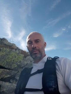
I reach the first peak (Costa Rossa at Km 5.7 at around 12:30 for a new snack (I move slightly off-center to stay quiet since there were many people there). After taking the customary photos next to the pillar, I start trotting again, observing the other lower peaks along the rocky ridge. Going towards the 'Central Spur' (second peak at 2270m), there are several boulders to cross that slow down the pace a lot. The long poles helped me here, but my hands proved to be indispensable at some points to provide support! Just one photo, and then further ahead at the path that becomes a real stone field towards the third peak at kilometer 8.3 (Bisamauda, the true peak of Bisalta) at an altitude of 2250m. I advance a bit more towards the fourth peak, and even though it is lower, I struggle because the rocky terrain becomes even more rugged in the face of a path hardly marked except for a few small piles of stones not very visible (Anticima Bisalta 2190m). Here, there are few people, and I decide to return at kilometer 8.5 because the loop I had planned to close after reaching all the peaks of Bisalta, at that point, I realize it's not feasible due to the danger of the stretch before the long final descent. Moreover, the large number of photos of victims of this mountain point has an effect (attention, the mountain is dangerous!), and seeing the difficult path does not surprise me at all.


Pillar Costa Rossa from the adjacent peak

Extending the route by a good 3 km, I turn around and retrace all the peaks with the accompanying stone field. The pace here is again very slow, but no matter because seeing that panorama again is priceless. Also, on the way back, I almost don't meet anyone anymore because it's already past 3:00 PM. The breeze from the watershed begins to be felt, so I consider whether to put on the fleece, but I give up since to return to Costa Rossa, I'll have more positive elevation, and to avoid sweating too much, I stay in short sleeves.

The ridge


When I leave the peaks towards the return, I find again the first meadows in the opposite direction, and here the path finally becomes easy and runnable. I have a new small snack (dried figs that I love and squares of Grana cheese, which I consume all the time) and then set off for the final descent through the woods. The last kilometers to the car are along the river, which has a low water level (like all Alpine rivers by now) but still makes the typical sound (decidedly calming). A leisurely walk along the narrow dirt road, which after a while becomes asphalted. At the parking lot, I meet a guy I had seen at the top, and we chat for a bit, then I pack everything into the car. The final arrival took place at around 5:05 PM (estimated) for a distance according to the GPS of 20.66 km and a total time of 7 hours and 36 minutes.
Considering that from Bisalta, I understood that I can reach Limone Piemonte, in the next outings, I will not hesitate to explore this corner of the Cuneo province again! By this time, practically all the hikers had disappeared, but we know that in Italy, mountain culture is weak. There are always many people who 'in words' would like to 'do,' but then in reality, almost all of them get lost, unfortunately! A glimpse of the powerful stone field View downhill from the stone field


Considering the injury mentioned at the beginning, I can write that the recovery has been excellent since I felt no pain at all in the ankle, which opens the doors to new adventures on foot thanks to the Weekly Mono-Training technique, which even in this moment of forced pause has behaved very well as I did not perceive the interruption. I took two twists on the same limb in the final descent, but they were 'metabolized' without consequences. PS: I want to clarify that in this adventure, I have not been very diligent in mentioning timed times and distances since I have been advancing for many years without paying much attention to the 'numbers,' but in previous adventures, I made an effort to mention them in the videos to make users who were interested happy. All the data reported here was therefore obtained from the GPS track examined later, during the writing of these lines. I believe that for consistency with the thoughts I have nurtured for a long time on long walks, I will always proceed in this way. I apologize to those who want to view the numbers, but they can still do so by reading the text that always follows my walking adventures. GPS watch and phone for me are only directional indicators!


.png)
Map
I add the WikiLoc track here, even though I noticed that it differs from the Garmin GPS Track:
Link to WikiLoc Track: https://it.wikiloc.com/percorsi-escursionismo/tutte-le-punte-della-bisalta-28-10-2023-151642008
Live Video:
Below is the detail of the reference links related to my ultratrail and trail
articles:
Very long distances |
Routes |
Competitions |
Solo adventures |
Publications |
Training strategy |
UltraTrail eBook
Nessun commento:
Posta un commento